Thimble Shoal Light Station

Why it's listed
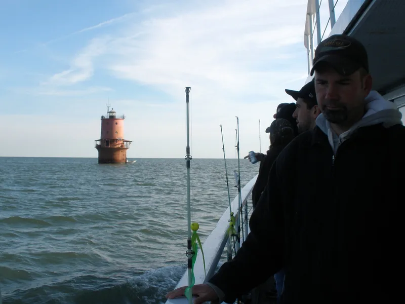
Thimble Shoal Light Station is an offshore lighthouse standing in about 11 feet of water on the shallowest part of Thimble Shoal, beside the Hampton Roads channel in the Chesapeake Bay. It is reached only by boat. A wooden caisson supports a 42-foot-diameter cast-iron cylinder filled with concrete, and a three-story conical cast-iron tower and dwelling rises from it, topped by a black fourth-order lantern. The present structure went into service on December 1, 1914, after repeated disasters at the site: a screwpile lighthouse first lit in 1872 was damaged by fire and by ship collisions, and was destroyed in 1909 when a towed schooner rammed it. The station is one of eleven pneumatic caisson lighthouses built in the United States, seven of them in the Chesapeake Bay and three in Virginia. It still has its lower gallery roof, which most caisson lighthouses lost. It was automated in 1964.
Significance in brief: It is tied to federal efforts to build an integrated system of navigational aids for safe shipping in the Chesapeake Bay. It is also a representative example of the pneumatic caisson lighthouse, of which eleven were built in the United States, seven of them in the Chesapeake Bay and three in Virginia. It retains its lower gallery roof, a feature removed from most similar lighthouses.
Machine-generated summary. This summary was generated by a language model from the official nomination document and has not been reviewed line by line by an editor. It may contain errors. Check the source document before relying on any detail. Source: nomination document (PDF) · National Archives catalog entry. NRHP reference 02001436, listed December 2, 2002. Summary generated October 2026 (model claude-sonnet-5-5, prompt v1.0-2026-10-29, confidence high).
Key facts
| Address | Approx. 1.5 mi. E of Fort Monroe Military Reservation, Hampton City (Independent City) |
|---|---|
| County | Hampton |
| Listed | December 2, 2002 |
| Reference number | 02001436 |
| Resource type | Structure |
| Period of significance | 1914-1952 |
| Architect / builder | U.S. Lighthouse Board |
| Architectural style | No Style |
| Criteria |
|
| Areas of significance | Maritime History, Transportation, Architecture |
| Level of significance | Local |
| Status (as stated in the nomination) | Automated in 1964, with a solar electric generator installed in 1986-87 and a major refurbishment in 1988. The gallery roof is in poor condition, and the form lists transportation (water-related) as the current function. |
| Acreage | 0.9 |
| Coordinates | 37.01732, -76.23968 (NPS GIS) |
What listing means for this property
For a publicly owned building or structure, listing mainly matters when federal funds, permits or licences are involved: projects then go through Section 106 review so effects on the property are considered. Listing also strengthens applications for preservation grants and, for leased income-producing uses, can enable the federal rehabilitation tax credit.
General information, not legal or tax advice. Rules change; confirm with your State Historic Preservation Office or a qualified adviser.
Sources and further reading
- National Park Service, National Register of Historic Places database (snapshot May 2026), reference 02001436.
- Nomination form (PDF, National Archives) — catalog entry
- Wikipedia article (used for cross-checking only; text not reproduced here)
- Wikidata Q7784202
- This listing as JSON
Last updated October 2026. Found an error? See the editorial policy for how to report it.