Staunton River State Park Historic District
Also known as: Staunton River State Park; DHR Number: 041-0100

Why it's listed
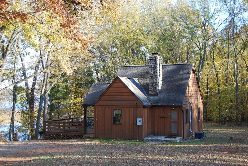
Staunton River State Park occupies rolling, forested land where the Dan and Staunton (Roanoke) Rivers meet in Halifax County, Virginia. Most of its core was built by the Civilian Conservation Corps between 1933 and 1942 as part of Virginia's first state park system. A main road laid out to National Park Service guidelines runs from the entrance to a bluff-top cabin area overlooking the river. Along it are a restaurant with a camp store wing, a pool and bath house, two picnic areas with stone-foundation shelters, a boat storage building, a campground and hiking trails. Eight CCC-era cabins of board-and-batten and fieldstone survive, though many have updated interiors and porches. The district was listed for its link to the CCC and state park development, and for the integrity of its park plan and rustic buildings. It counts 24 contributing and 32 noncontributing resources, and the restaurant has stood vacant since about 1992.
Significance in brief: The district is considered significant for its association with the Civilian Conservation Corps and the development of Virginia's state park system. It also reflects National Park Service park planning and rustic design principles, and retains integrity in its park plan and buildings.
Machine-generated summary. This summary was generated by a language model from the official nomination document and has not been reviewed line by line by an editor. It may contain errors. Check the source document before relying on any detail. Source: nomination document (PDF) · National Archives catalog entry. NRHP reference 07000402, listed May 4, 2007. Summary generated October 2026 (model claude-sonnet-5-5, prompt v1.0-2026-10-29, confidence medium).
Key facts
| Address | 1170 Staunton Trail, Scottsburg |
|---|---|
| County | Halifax County |
| Listed | May 4, 2007 |
| Reference number | 07000402 |
| Resource type | District |
| Period of significance | 1933-1942 |
| Architect / builder | A. C. Barlow (designed the 1941 camp store addition); built by the Civilian Conservation Corps |
| Architectural style | Late 19th and Early 20th Century American Movements; Modern Movement |
| Criteria |
|
| Areas of significance | Architecture, Landscape Architecture, Entertainment/Recreation |
| Level of significance | State |
| Status (as stated in the nomination) | The restaurant/visitor's center closed around 1992 and is described as vacant and scheduled for restoration; the rest of the park remains in use for camping, cabins, picnicking, boating and recreation. |
| Coordinates | 36.69772, -78.67345 (NPS GIS) |
What listing means for this property
This is a historic district. Buildings within its boundary are either contributing (they add to the district's significance) or non-contributing. Owners of contributing income-producing buildings can claim the 20% federal rehabilitation tax credit; homeowners should look at state credits. National Register districts impose no design review by themselves; a local historic district ordinance, if one exists, does (the difference explained).
General information, not legal or tax advice. Rules change; confirm with your State Historic Preservation Office or a qualified adviser.
Sources and further reading
- National Park Service, National Register of Historic Places database (snapshot May 2026), reference 07000402.
- Nomination form (PDF, National Archives) — catalog entry
- Wikidata Q114359463
- This listing as JSON
Last updated October 2026. Found an error? See the editorial policy for how to report it.