Ripshin
Also known as: Ripshin Farm; Sherwoood Anderson Farm
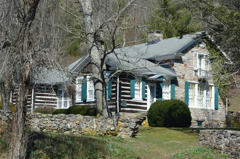

Why it's listed
Ripshin is a building located on the north side of Route 732, roughly one-tenth of a mile east of its intersection with Route 603, near Trout Dale in Grayson County, Virginia. A 1970 photograph taken from the north is captioned as the Sherwood Anderson House. The property was entered in the National Register of Historic Places on September 22, 1971, after the Virginia Historic Landmarks Commission sent its submission in March 1971. A later locator card marks it as a National Historic Landmark and gives the landmark name as Ripshin Farm. The surviving file consists mainly of a photograph form, a map form based on the 1959 Trout Dale, Virginia, USGS quadrangle, and administrative correspondence. The nomination form with the description and statement of significance is missing, so the architect, builder, style, construction date and reasons for listing cannot be stated from this record.
Significance in brief: The nomination form itself is missing from the file, so no statement of significance is available. The only hint of its importance is a photo caption naming it the Sherwood Anderson House and a status note listing it as a National Historic Landmark under the name Ripshin Farm.
Machine-generated summary. This summary was generated by a language model from the official nomination document and has not been reviewed line by line by an editor. It may contain errors. Check the source document before relying on any detail. Source: nomination document (PDF) · National Archives catalog entry. NRHP reference 71000979, listed September 22, 1971. Summary generated October 2026 (model claude-sonnet-5-5, prompt v1.0-2026-10-29, confidence low).
Key facts
| Address | Near jct. of VA 603 and 732, Trout Dale |
|---|---|
| County | Grayson County |
| Listed | September 22, 1971 |
| Reference number | 71000979 |
| Resource type | Building |
| Areas of significance | Education |
| Level of significance | National |
| National Historic Landmark | Yes, designated November 11, 1971 |
| Acreage | 140 |
| Coordinates | 36.69710, -81.40750 (NPS GIS) |
What listing means for this property
National Register listing is honorary: it recognises significance and does not restrict what a private owner may do without federal money or permits. It unlocks the 20% federal rehabilitation tax credit for income-producing buildings, state credits in many states, and Section 106 review when federal agencies are involved. See what listing means in practice.
General information, not legal or tax advice. Rules change; confirm with your State Historic Preservation Office or a qualified adviser.
Sources and further reading
- National Park Service, National Register of Historic Places database (snapshot May 2026), reference 71000979.
- Nomination form (PDF, National Archives) — catalog entry
- Wikipedia article (used for cross-checking only; text not reproduced here)
- Wikidata Q7335755
- This listing as JSON
Last updated October 2026. Found an error? See the editorial policy for how to report it.