Brookside Farm and Mill
Also known as: Cox, M.B, House and Phipps Mill; Saddle Creek Mill

Why it's listed
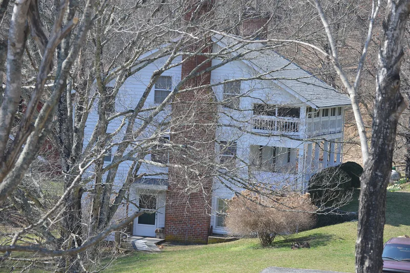
Brookside Farm & Mill occupies 447 mostly wooded acres along Saddle Creek, west of Independence in Grayson County, Virginia. Captain M. B. Cox began acquiring land here in the 1870s and formed a milling partnership in 1876. The three-story timber-frame mill, finished in 1877 by builder Robert Landreth, still holds two pairs of millstones, a steel overshot waterwheel and roller equipment added in 1914. The 1877 two-story frame house beside it has brick nogging and tall handmade brick chimneys. Other buildings include a brick springhouse and smokehouse, a log corn crib, a miller's cabin, the Graham House, and a 1918 service station that once stood along the old turnpike. The Cox family has held the property since it was established. It was recognized locally for its role in agriculture, commerce and industry, for the mill's engineering, and for an unusually intact group of structures dating from 1876 to 1955.
Significance in brief: The nomination argues the complex is significant under Criterion A for its history as a small, prosperous farm and grain-processing operation that served the local community, and for the 1918 service station's role in commerce and transportation. Under Criterion C, the mill is notable for engineering across two construction and milling periods, and the whole property for its well-preserved collection of structures dating from 1876 to 1955.
Machine-generated summary. This summary was generated by a language model from the official nomination document and has not been reviewed line by line by an editor. It may contain errors. Check the source document before relying on any detail. Source: nomination document (PDF) · National Archives catalog entry. NRHP reference 05001272, listed November 16, 2005. Summary generated October 2026 (model claude-sonnet-5-5, prompt v1.0-2026-10-29, confidence medium).
Key facts
| Address | 4161 Wilson Hwy., Independence |
|---|---|
| County | Grayson County |
| Listed | November 16, 2005 |
| Reference number | 05001272 |
| Resource type | Building |
| Period of significance | 1876-1955 |
| Architect / builder | Robert Landreth; Samuel M. Fulton; F.M. Cox |
| Architectural style | Other: Late 19th-century vernacular |
| Criteria |
|
| Areas of significance | Agriculture, Commerce, Industry, Engineering, Architecture, Transportation |
| Level of significance | Local |
| Status (as stated in the nomination) | Current functions listed include single dwelling, secondary structure, storage, and vacant/not in use. The mill equipment is described as surviving largely in place and in good condition. |
| Acreage | 447 |
| Coordinates | 36.61717, -81.22520 (NPS GIS) |
What listing means for this property
National Register listing is honorary for a privately owned home: it does not by itself restrict what an owner may do with their own money, and it does not require public access. Restrictions come from local landmark or historic-district ordinances, which are separate (how they differ).
Owner-occupied houses are not eligible for the 20% federal rehabilitation tax credit, which applies to income-producing buildings, but many states offer credits for homeowners. Listing also opens the door to preservation easements and to buying a plaque. Start with what listing means for homeowners, renovating a listed house and selling one.
General information, not legal or tax advice. Rules change; confirm with your State Historic Preservation Office or a qualified adviser.
Sources and further reading
- National Park Service, National Register of Historic Places database (snapshot May 2026), reference 05001272.
- Nomination form (PDF, National Archives) — catalog entry
- Wikipedia article (used for cross-checking only; text not reproduced here)
- Wikidata Q14712092
- This listing as JSON
Last updated October 2026. Found an error? See the editorial policy for how to report it.