Hicksford-Emporia Historic District
Also known as: Emporia

Why it's listed
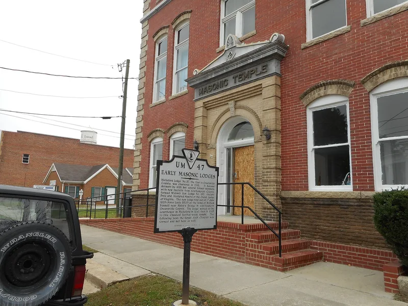
Emporia's historic core is a linear district along South Main Street and the first block of Brunswick Avenue, covering about 19.7 acres. The town formed in 1887 when Hicksford and Belfield merged, and it grew as a railroad-connected agricultural center and county seat. The 1831 Greensville County Courthouse, with its two-story Ionic portico and green, anchors the layout. West of it, one- to three-story brick storefronts with display windows, transoms and corbelled cornices make up the commercial blocks. Notable buildings include the 1902 Merchants and Farmers Bank, the Neo-classical Citizens National Bank, the 1905 Masonic Temple, two early twentieth-century churches, and school buildings from 1907 and 1925. Three Depression-era buildings, the Armory, the County Auditorium and the Post Office with its 1941 mural, were built under the WPA. The district is considered significant for its commercial and governmental development and its commercial architecture. Its period of significance ends in 1957, when Interstate 95 bypassed the town.
Significance in brief: The district is recommended eligible under Criterion A for its link to the early to mid-20th century commercial and governmental growth of Greensville County, and under Criterion C for its early to mid-20th century commercial architecture. Its buildings show a small agricultural town developing into a commercial and government center.
Machine-generated summary. This summary was generated by a language model from the official nomination document and has not been reviewed line by line by an editor. It may contain errors. Check the source document before relying on any detail. Source: nomination document (PDF) · National Archives catalog entry. NRHP reference 07001217, listed November 20, 2007. Summary generated October 2026 (model claude-sonnet-5-5, prompt v1.0-2026-10-29, confidence medium).
Key facts
| Address | S Main St. & Brunswick Ave., Emporia (Independent City) |
|---|---|
| County | Emporia |
| Listed | November 20, 2007 |
| Reference number | 07001217 |
| Resource type | District |
| Period of significance | Through 1957 (start date not stated in the provided text) |
| Architectural style | Commercial Style, Neo-Classical, Art Deco |
| Criteria |
|
| Areas of significance | Commerce, Politics/Government, Architecture |
| Level of significance | Local |
| Status (as stated in the nomination) | Most resources contribute, though many storefronts have been altered; 13 noncontributing resources include 1970s buildings. Hurricane Hazel in 1954 destroyed some buildings, which were replaced with mid-century brick commercial buildings. |
| Acreage | 19.7 |
| Coordinates | 36.68769, -83.54300 (NPS GIS) |
What listing means for this property
This is a historic district. Buildings within its boundary are either contributing (they add to the district's significance) or non-contributing. Owners of contributing income-producing buildings can claim the 20% federal rehabilitation tax credit; homeowners should look at state credits. National Register districts impose no design review by themselves; a local historic district ordinance, if one exists, does (the difference explained).
General information, not legal or tax advice. Rules change; confirm with your State Historic Preservation Office or a qualified adviser.
Sources and further reading
- National Park Service, National Register of Historic Places database (snapshot May 2026), reference 07001217.
- Nomination form (PDF, National Archives) — catalog entry
- Wikipedia article (used for cross-checking only; text not reproduced here)
- Wikidata Q15223858
- This listing as JSON
Last updated October 2026. Found an error? See the editorial policy for how to report it.