Great Bridge Battle Site

Why it's listed
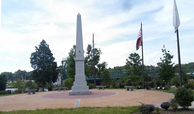
This 130-acre site straddles the Albemarle and Chesapeake Canal in Chesapeake, Virginia, where a colonial bridge and causeway once carried traffic over about 360 yards of marsh and open water on the land route to Norfolk. On December 9, 1775, British and Loyalist troops from Lord Dunmore's fort marched south across the bridge to attack American patriots entrenched on dry ground beyond. The brief fight was the first pitched battle of the Revolution in Virginia. Patriot losses were limited to one wounded man, while the British suffered heavy casualties. Crown forces abandoned the fort, the road to Norfolk was open, and many Loyalists fled the region. The British fortified the position again in 1781 under General Benedict Arnold, with the Queen's Rangers stationed there. Modern roads and the canal have disturbed parts of the area, yet the marshland setting survives. A knoll north of the bridge may hold intact remains of Dunmore's fort, and wet conditions favor preservation of buried remains.
Significance in brief: It is the location of the first pitched battle of the Revolution in Virginia, and the first armed conflict between British soldiers and the colony's patriot forces. The British defeat opened the land route to Norfolk and demoralized Loyalists. The marsh may also hold archaeological evidence of Dunmore's 1775 fort and buried British soldiers.
Machine-generated summary. This summary was generated by a language model from the official nomination document and has not been reviewed line by line by an editor. It may contain errors. Check the source document before relying on any detail. Source: nomination document (PDF) · National Archives catalog entry. NRHP reference 73002205, listed March 28, 1973. Summary generated October 2026 (model claude-sonnet-5-5, prompt v1.0-2026-10-29, confidence medium).
Key facts
| Address | Both sides of the Albemarle and Chesapeake Canal between Oak Grove and Great Bridge, Chesapeake (Independent City) |
|---|---|
| County | Chesapeake |
| Listed | March 28, 1973 |
| Reference number | 73002205 |
| Resource type | Site |
| Period of significance | 18th Century (specific date 1775) |
| Areas of significance | Military |
| Level of significance | State |
| Status (as stated in the nomination) | Condition marked fair and altered; many modern intrusions disturb the area next to the bridge, but the battlefield keeps its original marshland character. The 1781 British fort site is probably destroyed by the canal. |
| Acreage | 130 |
| Coordinates | 36.72424, -76.23932 (NPS GIS) |
What listing means for this property
Sites (archaeological sites, battlefields, landscapes) are often listed with a restricted address to protect them from looting or disturbance. Listing is honorary for private owners; federal undertakings on or near the site go through Section 106 review, and state laws may protect burials and artefacts regardless of listing.
General information, not legal or tax advice. Rules change; confirm with your State Historic Preservation Office or a qualified adviser.
Sources and further reading
- National Park Service, National Register of Historic Places database (snapshot May 2026), reference 73002205.
- Nomination form (PDF, National Archives) — catalog entry
- Wikidata Q23838087
- This listing as JSON
Last updated October 2026. Found an error? See the editorial policy for how to report it.