Centreville-Fentress Historic District
Also known as: Centre Hill

Why it's listed
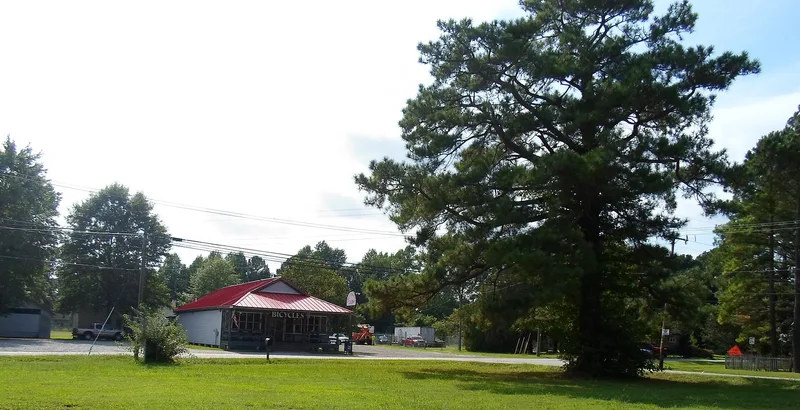
Centreville-Fentress is a rural crossroads community in Chesapeake, Virginia, spread over 257 acres. It formed where Fentress Road, the old Great Road between Norfolk and Elizabeth City, North Carolina, met Centerville Turnpike and Blue Ridge Road. The turnpike, created in 1878, carried farm produce to docks on the Albemarle and Chesapeake Canal, and a railroad station opened in 1881. Local truck farmers used these routes to reach distant markets. Land sales near the junction supported a small commercial core, a Baptist church and a growing number of houses. Most buildings are modest frame dwellings with Colonial Revival, Queen Anne and Craftsman details, along with a few mid-19th-century farmhouses, a monumental 1920s brick church and a frame country store. Passenger rail service ended in 1932 and the station was demolished in 1940. The district contains 34 contributing resources and is significant for transportation and community development between 1871 and 1940.
Significance in brief: The district is significant under Criteria A and C for Transportation and Community Planning and Development. A road link to the Albemarle and Chesapeake Canal and the arrival of the railroad in 1881 turned a farming area into a commercial crossroads community for local truck farmers. It is one of the few remaining rural railroad towns in the former Norfolk County.
Machine-generated summary. This summary was generated by a language model from the official nomination document and has not been reviewed line by line by an editor. It may contain errors. Check the source document before relying on any detail. Source: nomination document (PDF) · National Archives catalog entry. NRHP reference 03000562, listed June 23, 2003. Summary generated October 2026 (model claude-sonnet-5-5, prompt v1.0-2026-10-29, confidence medium).
Key facts
| Address | Roughly bounded by Fentress Rd., Centerville Tnpk., Blue Ridge Rd., Whittamore Rd., Chesapeake |
|---|---|
| County | Chesapeake |
| Listed | June 23, 2003 |
| Reference number | 03000562 |
| Resource type | District |
| Period of significance | 1871-1940 |
| Architect / builder | John S. King, General Contractor |
| Architectural style | Mid-19th Century; Colonial Revival, Queen Anne; Bungalow/Craftsman; Modern Movement |
| Criteria |
|
| Areas of significance | Community Planning and Development, Transportation |
| Level of significance | Local |
| Status (as stated in the nomination) | Most buildings remain in use as dwellings, with a church, a country store and farm outbuildings. The railroad station was demolished in 1940, and newer housing and a golf course now border the district. |
| Acreage | 257 |
| Coordinates | 36.69580, -76.17277 (NPS GIS) |
What listing means for this property
This is a historic district. Buildings within its boundary are either contributing (they add to the district's significance) or non-contributing. Owners of contributing income-producing buildings can claim the 20% federal rehabilitation tax credit; homeowners should look at state credits. National Register districts impose no design review by themselves; a local historic district ordinance, if one exists, does (the difference explained).
General information, not legal or tax advice. Rules change; confirm with your State Historic Preservation Office or a qualified adviser.
Sources and further reading
- National Park Service, National Register of Historic Places database (snapshot May 2026), reference 03000562.
- Nomination form (PDF, National Archives) — catalog entry
- Wikipedia article (used for cross-checking only; text not reproduced here)
- Wikidata Q15208523
- This listing as JSON
Last updated October 2026. Found an error? See the editorial policy for how to report it.