Albermarle and Chesapeake Canal Historic District

Why it's listed
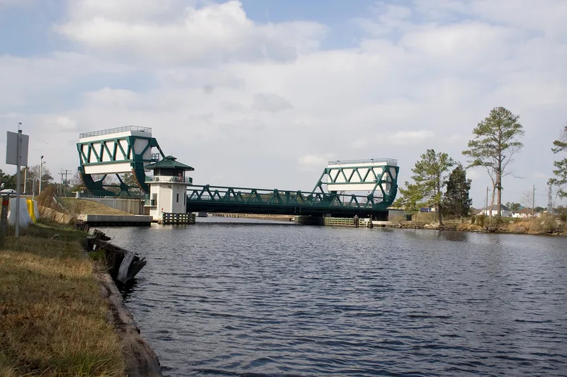
This linear district in Chesapeake, Virginia, follows the 9.1-mile Virginia Cut of the Albemarle & Chesapeake Canal, which links the Southern Branch of the Elizabeth River with the North Landing River. Dug between 1856 and 1859 under the canal company led by Marshall Parks, Jr., it was among the first canals designed for steam vessels, had no towpath, and was the first in Virginia built entirely by steam dredging. Its reversible tidal lock at Great Bridge was the largest of its kind on the East Coast. The federal government bought the canal in 1913 and folded it into the Atlantic Intracoastal Waterway. The Army Corps of Engineers widened it, built a maintenance reservation with eight contributing buildings dating from 1917 to 1948, and completed the present 600-foot lock in 1931-1932. The district also contains the site of the Battle of Great Bridge, fought in December 1775, the first Revolutionary War engagement in Virginia. Its period of significance runs from 1775 to 1953.
Significance in brief: The canal was an early steam-dredged waterway with no towpath and a very large reversible tidal lock, regarded as an engineering marvel in 1859. The federal government bought it in 1913 and made it part of the Atlantic Intracoastal Waterway, and the Corps of Engineers later improved it. The district also includes the site of the first Revolutionary War engagement in Virginia. It is significant in transportation, military history and engineering.
Machine-generated summary. This summary was generated by a language model from the official nomination document and has not been reviewed line by line by an editor. It may contain errors. Check the source document before relying on any detail. Source: nomination document (PDF) · National Archives catalog entry. NRHP reference 04000035, listed February 11, 2004. Summary generated October 2026 (model claude-sonnet-5-5, prompt v1.0-2026-10-29, confidence medium).
Key facts
| Address | Albemarel and Chesapeake Canal, Chesapeake (Independent city) |
|---|---|
| County | Chesapeake |
| Listed | February 11, 2004 |
| Reference number | 04000035 |
| Resource type | District |
| Period of significance | 1775-1953 |
| Architect / builder | Unknown |
| Criteria |
|
| Areas of significance | Transportation, Military, Engineering |
| Level of significance | State |
| Status (as stated in the nomination) | The canal is part of the federally operated Atlantic Intracoastal Waterway and carries heavy commercial and some recreational traffic. The form lists current functions including water and road transportation, with some military-related uses and some resources vacant or not in use. |
| Acreage | 1704 |
| Coordinates | 36.72631, -76.10879 (NPS GIS) |
What listing means for this property
This is a historic district. Buildings within its boundary are either contributing (they add to the district's significance) or non-contributing. Owners of contributing income-producing buildings can claim the 20% federal rehabilitation tax credit; homeowners should look at state credits. National Register districts impose no design review by themselves; a local historic district ordinance, if one exists, does (the difference explained).
General information, not legal or tax advice. Rules change; confirm with your State Historic Preservation Office or a qualified adviser.
Sources and further reading
- National Park Service, National Register of Historic Places database (snapshot May 2026), reference 04000035.
- Nomination form (PDF, National Archives) — catalog entry
- Wikipedia article (used for cross-checking only; text not reproduced here)
- Wikidata Q4709505
- This listing as JSON
Last updated October 2026. Found an error? See the editorial policy for how to report it.