Douthat State Park Historic District
Also known as: Douthat State Park

Why it's listed
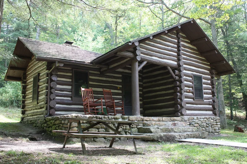
Douthat State Park in Alleghany and Bath counties, Virginia, covers 4,493 acres and is organized around a fifty-acre lake formed by a dam on Wilson Creek. Between 1933 and 1942, three camps of the Civilian Conservation Corps built nearly everything of historic interest: twenty-five log cabins, a guest lodge, a superintendent's residence, a restaurant, a bathhouse, a boathouse, picnic and camping shelters, maintenance buildings, a fire lookout cabin and forty miles of trails. Developed areas occupy about one-seventh of the park, grouped by function to protect the surrounding landscape. The log buildings, with stone foundations, fireplaces and hand-wrought hardware, exemplify rustic park design, and four of them appeared in the National Park Service's Park Structures and Facilities. Later buildings from 1951 to 1976 do not contribute, though most were designed to blend with the earlier work. The district retains the character of its original 1930s design and reflects the era's state park movement.
Significance in brief: The district is presented as a leading example of the Progressive and New Deal era movement to create state parks and of rustic park architecture. The CCC built all contributing buildings, the dam and lake, and forty miles of trails. Its log cabins, lodge and superintendent's residence were praised and published in the National Park Service's Park Structures and Facilities.
Machine-generated summary. This summary was generated by a language model from the official nomination document and has not been reviewed line by line by an editor. It may contain errors. Check the source document before relying on any detail. Source: nomination document (PDF) · National Archives catalog entry. NRHP reference 86002183, listed September 20, 1986. Summary generated October 2026 (model claude-sonnet-5-5, prompt v1.0-2026-10-29, confidence medium).
Key facts
| Address | VA 629, Millboro |
|---|---|
| County | Alleghany County |
| Listed | September 20, 1986 |
| Reference number | 86002183 |
| Resource type | District |
| Architect / builder | Civilian Conservation Corps (CCC Companies 1373 and 1374); Lee H. Williamson, dam designing engineer; plans signed by Burson |
| Architectural style | Rustic architecture (log construction, with some wood-frame buildings) |
| Areas of significance | Community Planning and Development, Landscape Architecture, Conservation, Engineering, Architecture, Social History |
| Level of significance | State |
| Status (as stated in the nomination) | Occupied and in use as a state park; most buildings are in good or excellent condition, with interior improvements to cabins under way. |
| Acreage | 4493 |
| Coordinates | 37.89534, -79.81122 (NPS GIS) |
What listing means for this property
This is a historic district. Buildings within its boundary are either contributing (they add to the district's significance) or non-contributing. Owners of contributing income-producing buildings can claim the 20% federal rehabilitation tax credit; homeowners should look at state credits. National Register districts impose no design review by themselves; a local historic district ordinance, if one exists, does (the difference explained).
General information, not legal or tax advice. Rules change; confirm with your State Historic Preservation Office or a qualified adviser.
Sources and further reading
- National Park Service, National Register of Historic Places database (snapshot May 2026), reference 86002183.
- Nomination form (PDF, National Archives) — catalog entry
- Wikidata Q99195318
- This listing as JSON
Last updated October 2026. Found an error? See the editorial policy for how to report it.