Moore's Crossing Historic District

Why it's listed
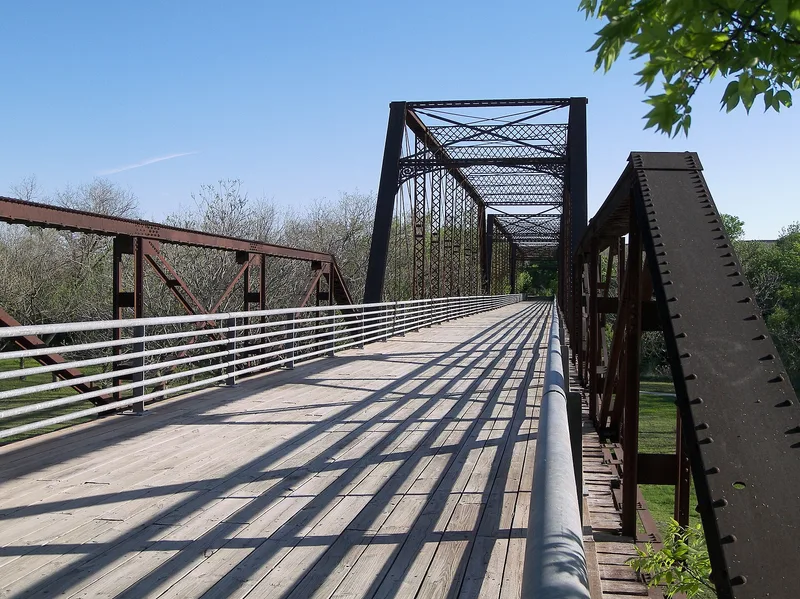
Moore's Crossing is a small rural community core in southeast Travis County, Texas, clustered beside a historic low-water ford on Onion Creek. The district covers about 10.83 acres and 21 resources, of which 13 contribute to its character. Most are modest one-story wood-frame vernacular buildings from the early 20th century. A country store built or rebuilt in 1914 serves as the focal point, along with an L-plan house of about 1893 showing Queen Anne influence and a metal-truss bridge. The bridge was reassembled from salvaged parts of the Congress Avenue Bridge over the Colorado River. The community grew slowly after the Civil War, serving nearby tenant and yeoman farms, and once had a school, cotton gin, blacksmith shops, a church and a meat market. Development was largely complete by the early 1920s. The district was listed because it keeps a rare cross-section of rural buildings, outbuildings, a ford and a bridge, while growth around Austin has erased similar settlements nearby.
Significance in brief: The district preserves the heart of Moore's Crossing, a rural commercial and social center that grew after the Civil War around a low-water ford on Onion Creek. Its country store, houses, outbuildings, ford and metal-truss bridge show the kinds of buildings once common in rural Travis County. Few similar communities near Austin have survived intact.
Machine-generated summary. This summary was generated by a language model from the official nomination document and has not been reviewed line by line by an editor. It may contain errors. Check the source document before relying on any detail. Source: nomination document (PDF) · National Archives catalog entry. NRHP reference 96001091, listed October 16, 1996. Summary generated October 2026 (model claude-sonnet-5-5, prompt v1.0-2026-10-29, confidence medium).
Key facts
| Address | Roughly bounded by FM 973, old Burleson Rd. and Onion Cr., Austin |
|---|---|
| County | Travis County |
| Listed | October 16, 1996 |
| Reference number | 96001091 |
| Resource type | District |
| Period of significance | Ends 1946 (start date not stated in the provided text) |
| Architect / builder | King Iron Bridge and Manufacturing Company of Cleveland, Ohio (bridge designer) |
| Architectural style | Queen Anne; 1-part commercial block; barn; center passage; vernacular |
| Areas of significance | Communications, Commerce, Agriculture |
| Level of significance | Local |
| Status (as stated in the nomination) | Some resources are abandoned and deteriorated; Contributing resources are in fair to good condition; other parts remain in use, including a possible salvage or repair business. |
| Acreage | 10.8 |
| Coordinates | 30.16761, -97.66199 (NPS GIS) |
What listing means for this property
This is a historic district. Buildings within its boundary are either contributing (they add to the district's significance) or non-contributing. Owners of contributing income-producing buildings can claim the 20% federal rehabilitation tax credit; homeowners should look at state credits. National Register districts impose no design review by themselves; a local historic district ordinance, if one exists, does (the difference explained).
General information, not legal or tax advice. Rules change; confirm with your State Historic Preservation Office or a qualified adviser.
Sources and further reading
- National Park Service, National Register of Historic Places database (snapshot May 2026), reference 96001091.
- Nomination form (PDF, National Archives) — catalog entry
- Wikipedia article (used for cross-checking only; text not reproduced here)
- Wikidata Q6908097
- This listing as JSON
Last updated October 2026. Found an error? See the editorial policy for how to report it.