Shafter Historic Mining District

Why it's listed
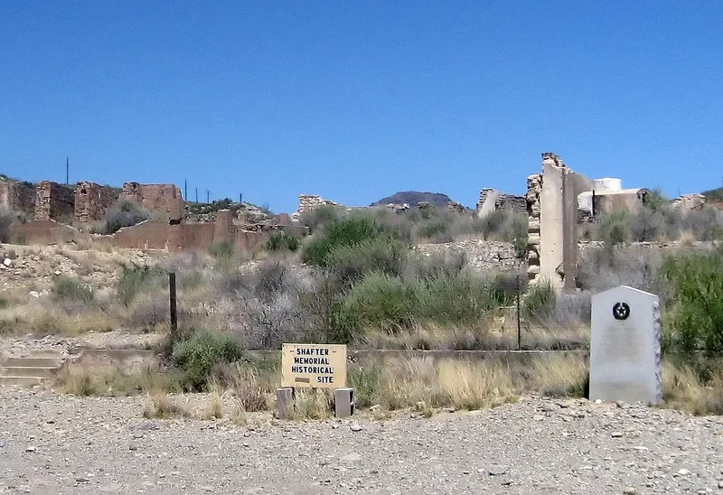
Shafter is a former silver mining town and smelter site on Cibolo Creek beside U.S. 67, about 20 miles north of Presidio in Presidio County, Texas. Silver was identified in the Chinati Mountains in the early 1880s, and Major William B. Shafter helped form the Presidio Mining Company. Over the decades the mines produced about $20,000,000 in silver and large quantities of lead, with about 300 employees at a time. The company provided a club house, hospital, boarding house and miners' housing. Residents built the surviving stone and adobe structures from native materials and salvaged mine timber. A National Guard and later Army camp operated here from 1916 to 1920 to guard against border raids. Mining ended in 1942. The district includes an adobe church, residences, ruins and smelter remains. It is considered the first major mining town in west Texas, and its partly occupied, undisturbed ruins hold archeological potential that has not yet been studied.
Significance in brief: Shafter was the first major mining town in west Texas and its only successful silver mining area. Its mines produced about $20,000,000 in silver and large amounts of lead. The site is still partly occupied, so the ruins are largely undisturbed and hold archeological data on the period of main occupation. It is also the only one of the region's early mining towns where people still live in the original buildings.
Machine-generated summary. This summary was generated by a language model from the official nomination document and has not been reviewed line by line by an editor. It may contain errors. Check the source document before relying on any detail. Source: nomination document (PDF) · National Archives catalog entry. NRHP reference 76002058, listed May 17, 1976. Summary generated October 2026 (model claude-sonnet-5-5, prompt v1.0-2026-10-29, confidence medium).
Key facts
| Address | 20 mi. N of Presidio on U.S. 67, Shafter |
|---|---|
| County | Presidio County |
| Listed | May 17, 1976 |
| Reference number | 76002058 |
| Resource type | District |
| Period of significance | 1886-1920 |
| Architect / builder | Built by the miners using native adobe and stone and timbers salvaged from the mines |
| Areas of significance | Commerce |
| Level of significance | State |
| Status (as stated in the nomination) | Partly occupied; 45 numbered structures are in excellent condition, and many ruins of stone and adobe buildings, including the smelter, survive. The mines themselves are outside the district. |
| Acreage | 300 |
| Coordinates | 29.81419, -104.30711 (NPS GIS) |
What listing means for this property
This is a historic district. Buildings within its boundary are either contributing (they add to the district's significance) or non-contributing. Owners of contributing income-producing buildings can claim the 20% federal rehabilitation tax credit; homeowners should look at state credits. National Register districts impose no design review by themselves; a local historic district ordinance, if one exists, does (the difference explained).
General information, not legal or tax advice. Rules change; confirm with your State Historic Preservation Office or a qualified adviser.
Sources and further reading
- National Park Service, National Register of Historic Places database (snapshot May 2026), reference 76002058.
- Nomination form (PDF, National Archives) — catalog entry
- Wikidata Q109999608
- This listing as JSON
Last updated October 2026. Found an error? See the editorial policy for how to report it.