International Boundary Marker
Also known as: Republic of Texas Granite Marker

Why it's listed
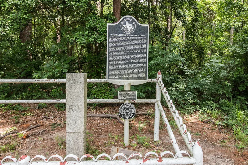
A four-foot granite shaft, six inches square, stands a short distance off FM 31 on the Texas-Louisiana line near Deadwood. It was prepared in 1840 and set in place in spring 1841 by a joint commission surveying the boundary between the United States and the Republic of Texas. Its faces are inscribed "R. T." on the west, "U.S." on the east and a meridian boundary notice dated 1840 on the south. The post marked the 32nd parallel, and mile markers were then run north to the Red River from it. Woodsmen rediscovered it in 1971, and it is the only remaining granite post of that 1841 boundary survey. The surveyors faced forests, swamps, fever, missing instruments and shortages of funds before reaching the Red River in June 1841. The marker is valued as an example of early American boundary engineering. A three-acre park dedicated in 1976 now memorializes it.
Significance in brief: The nomination argues it is the only remaining granite survey post marking the 1841 boundary between the United States and the Republic of Texas. It represents the difficult early nineteenth-century engineering work of surveying an international boundary, one negotiated with three foreign nations. It also served as the reference point for mile markers run northward to the Red River.
Machine-generated summary. This summary was generated by a language model from the official nomination document and has not been reviewed line by line by an editor. It may contain errors. Check the source document before relying on any detail. Source: nomination document (PDF) · National Archives catalog entry. NRHP reference 77001463, listed April 13, 1977. Summary generated October 2026 (model claude-sonnet-5-5, prompt v1.0-2026-10-29, confidence high).
Key facts
| Address | SE of Deadwood off SR 31 at LA State line, Deadwood |
|---|---|
| County | Panola County |
| Listed | April 13, 1977 |
| Reference number | 77001463 |
| Resource type | Object |
| Period of significance | 1800-1899 |
| Areas of significance | Engineering, Exploration/Settlement, Politics/Government |
| Level of significance | National |
| Status (as stated in the nomination) | Condition listed as excellent, unaltered and on its original site; a three-acre park dedicated in 1976 memorializes the marker, with the land owned by Texas and Louisiana interests on their respective sides. |
| Acreage | 3 |
| Coordinates | 32.03379, -94.04229 (NPS GIS) |
What listing means for this property
National Register listing is honorary: it recognises significance and does not restrict what a private owner may do without federal money or permits. It unlocks the 20% federal rehabilitation tax credit for income-producing buildings, state credits in many states, and Section 106 review when federal agencies are involved. See what listing means in practice.
General information, not legal or tax advice. Rules change; confirm with your State Historic Preservation Office or a qualified adviser.
Sources and further reading
- National Park Service, National Register of Historic Places database (snapshot May 2026), reference 77001463.
- Nomination form (PDF, National Archives) — catalog entry
- Wikipedia article (used for cross-checking only; text not reproduced here)
- Wikidata Q16892695
- This listing as JSON
Last updated October 2026. Found an error? See the editorial policy for how to report it.