State Highway 16, Brazos River Bridge Segment
Also known as: SH 16 from Brackeen Drive to SH 254
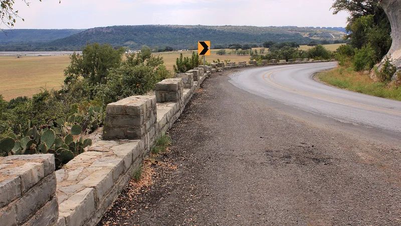

Approximate location: the National Park Service places this pin arbitrarily within the property, not at a surveyed point.
Why it's listed
No readable nomination text is available for this listing yet (nominations after 2012 are held by the National Park Service rather than the National Archives). The facts below come from the National Park Service database.
Key facts
| Address | TX 16 from 7.4 mi. NE. of US 180 to jct. of TX 16 & TX 254, Graford |
|---|---|
| County | Palo Pinto County |
| Listed | April 14, 2015 |
| Reference number | 15000153 |
| Resource type | District |
| Areas of significance | Transportation, Engineering |
| Level of significance | State |
| Acreage | 120 |
| Coordinates | 32.83619, -98.42895 (NPS GIS) |
What listing means for this property
This is a historic district. Buildings within its boundary are either contributing (they add to the district's significance) or non-contributing. Owners of contributing income-producing buildings can claim the 20% federal rehabilitation tax credit; homeowners should look at state credits. National Register districts impose no design review by themselves; a local historic district ordinance, if one exists, does (the difference explained).
General information, not legal or tax advice. Rules change; confirm with your State Historic Preservation Office or a qualified adviser.
Sources and further reading
- National Park Service, National Register of Historic Places database (snapshot May 2026), reference 15000153.
- Wikidata Q109999974
- This listing as JSON
Last updated October 2026. Found an error? See the editorial policy for how to report it.