Medina Dam

Why it's listed
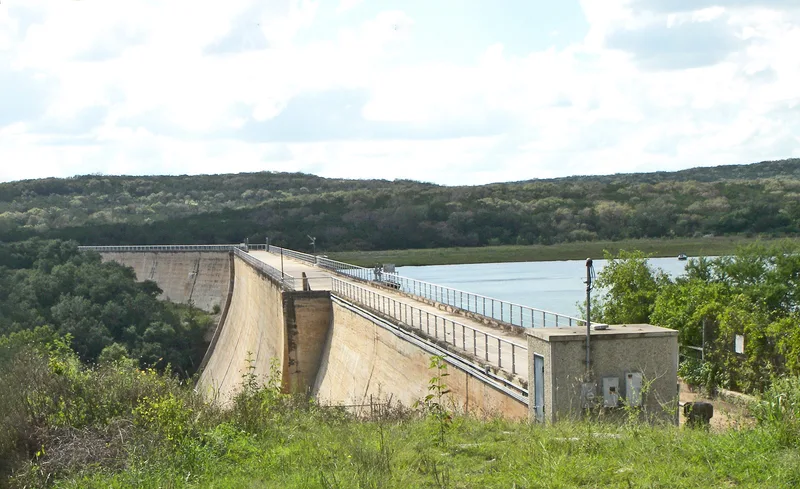
Medina Dam is a massive concrete gravity dam on the Medina River, roughly 40 miles west of San Antonio near Castroville. Built between 1911 and 1912 for an irrigation system created by engineer Fred Stark Pearson with British financing, it rises 164 feet above the riverbed and runs 1,580 feet from bluff to bluff. Its thickness tapers from 128 feet at the base to 25 feet at the top, and limestone boulders were embedded in the concrete to add bulk. A diversion dam four miles downstream sends water into about 300 miles of canals, flumes and ditches. On completion it was the fourth largest dam in the country and the largest in Texas. It was the first phase of a plan to settle and irrigate land west of San Antonio, and it was among the earliest projects of its size in Texas funded by private capital. The system still irrigates farms in three counties.
Significance in brief: It was the first phase of a master plan to irrigate and develop farmland west of San Antonio, designed by engineer Fred Stark Pearson. When finished it was the fourth largest dam in the United States and the largest in Texas. It was also one of the earliest projects of its size in Texas financed by private capital, and it still supplies irrigation water.
Machine-generated summary. This summary was generated by a language model from the official nomination document and has not been reviewed line by line by an editor. It may contain errors. Check the source document before relying on any detail. Source: nomination document (PDF) · National Archives catalog entry. NRHP reference 76002050, listed March 15, 1976. Summary generated October 2026 (model claude-sonnet-5-5, prompt v1.0-2026-10-29, confidence high).
Key facts
| Address | N of Castroville on the Medina River, Castroville |
|---|---|
| County | Medina County |
| Listed | March 15, 1976 |
| Reference number | 76002050 |
| Resource type | Structure |
| Period of significance | 1900- (specific dates 1911-12) |
| Architect / builder | Fred Stark Pearson |
| Areas of significance | Community Planning and Development, Engineering, Architecture |
| Level of significance | State |
| Status (as stated in the nomination) | Described as in excellent condition with only minor repairs to stop seepage; the whole system is in operation, irrigating fields in Bexar, Medina and Atascosa counties. |
| Acreage | 4.1 |
| Coordinates | 29.54051, -98.93425 (NPS GIS) |
What listing means for this property
For a publicly owned building or structure, listing mainly matters when federal funds, permits or licences are involved: projects then go through Section 106 review so effects on the property are considered. Listing also strengthens applications for preservation grants and, for leased income-producing uses, can enable the federal rehabilitation tax credit.
General information, not legal or tax advice. Rules change; confirm with your State Historic Preservation Office or a qualified adviser.
Sources and further reading
- National Park Service, National Register of Historic Places database (snapshot May 2026), reference 76002050.
- Nomination form (PDF, National Archives) — catalog entry
- Wikipedia article (used for cross-checking only; text not reproduced here)
- Wikidata Q6806915
- This listing as JSON
Last updated October 2026. Found an error? See the editorial policy for how to report it.