Castroville Historic District
Why it's listed
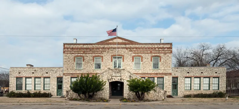
Castroville is an Alsatian community spread along both sides of the highway where it crosses the Medina River, twenty-five miles west of San Antonio. Ninety-six surveyed buildings date from 1844 to the 1880s and share a consistent character. Early houses were small two-room and loft structures of stuccoed limestone with tin or cypress shingle roofs, often with a rear kitchen giving a saltbox profile. Walls about eighteen inches thick kept interiors cool by day and warm at night, and decoration stayed simple even where Victorian brackets appear. Churches, commercial buildings and the courthouse share the same proportions. The town grew from a colony brought by empresario Henri Castro, who sent colonists, mostly from the Rhine Valley, to the Republic of Texas in the early 1840s. By 1847 about seven hundred people lived in seventy houses. Because the railroad and industry bypassed the town, its Alsatian look survived, and later additions have kept to the original scale.
Significance in brief: The district keeps the look and feel of a 1840s colony with ethnic unity and simple stuccoed stone buildings, architecturally distinct from most of Texas and the United States. It was founded under empresario Henri Castro, and bypassing by the railroad and industry helped preserve its Alsatian character. Later additions and new buildings have kept the harmony of the original town.
Machine-generated summary. This summary was generated by a language model from the official nomination document and has not been reviewed line by line by an editor. It may contain errors. Check the source document before relying on any detail. Source: nomination document (PDF) · National Archives catalog entry. NRHP reference 70000758, listed April 3, 1970. Summary generated October 2026 (model claude-sonnet-5-5, prompt v1.0-2026-10-29, confidence medium).
Key facts
| Address | Roughly bounded by Medina River, SR 471, Gime, Houston, and Constantinople, Castroville |
|---|---|
| County | Medina County |
| Listed | April 3, 1970 |
| Reference number | 70000758 |
| Resource type | District |
| Period of significance | 19th Century |
| Architectural style | Alsatian |
| Areas of significance | Architecture |
| Level of significance | Local |
| Status (as stated in the nomination) | Condition is marked fair and largely unaltered. Many houses have additions that keep the scale and character of the originals. The district is occupied as an entire community. |
| Acreage | 420.6 |
| Coordinates | 29.35604, -98.87956 (NPS GIS) |
What listing means for this property
This is a historic district. Buildings within its boundary are either contributing (they add to the district's significance) or non-contributing. Owners of contributing income-producing buildings can claim the 20% federal rehabilitation tax credit; homeowners should look at state credits. National Register districts impose no design review by themselves; a local historic district ordinance, if one exists, does (the difference explained).
General information, not legal or tax advice. Rules change; confirm with your State Historic Preservation Office or a qualified adviser.
Sources and further reading
- National Park Service, National Register of Historic Places database (snapshot May 2026), reference 70000758.
- Nomination form (PDF, National Archives) — catalog entry
- Wikipedia article (used for cross-checking only; text not reproduced here)
- Wikidata Q51000359
- This listing as JSON
Last updated October 2026. Found an error? See the editorial policy for how to report it.