Fort Duncan

Why it's listed
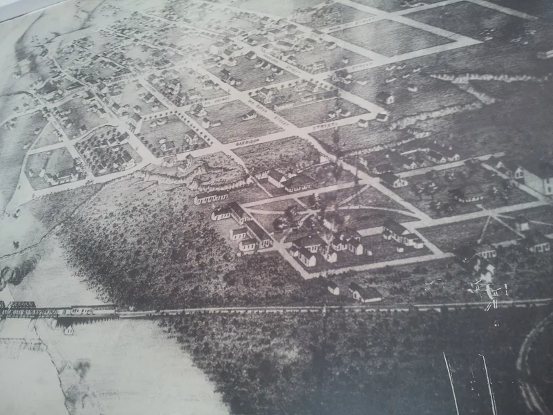
Fort Duncan is a former U.S. Army post on the Rio Grande at Eagle Pass, Texas. Established on March 27, 1849, it was the fifth in a line of frontier forts meant to protect settlers from Indian attacks. It also watched over the Mexico trade crossing at Eagle Pass and the California road. The fort was given up in 1859, regarrisoned in 1860 during the Cortinas disturbances, and used as a Confederate supply point for munitions obtained in Mexico. Federal troops returned in 1868, and in 1870 the Seminole-Negro Indian Scouts were organized here. The post was reactivated in 1917 and finally abandoned in 1922. The city bought the land in 1938 and made it a park. The surviving buildings are load-bearing stone structures with rough ashlar walls, wood lintels and whitewashed surfaces. Their interiors have been altered, but they remain typical of mid-nineteenth century military construction on the frontier.
Significance in brief: The nomination argues the fort is significant in military history as the fifth of the 1849 line of posts protecting the Texas frontier from Indians. It also guarded trade with Mexico crossing at Eagle Pass and the California road, served as a Confederate supply point for munitions from Mexico, and was where the Seminole-Negro Indian Scouts were organized in 1870. Its surviving stone buildings are typical frontier military architecture.
Machine-generated summary. This summary was generated by a language model from the official nomination document and has not been reviewed line by line by an editor. It may contain errors. Check the source document before relying on any detail. Source: nomination document (PDF) · National Archives catalog entry. NRHP reference 71000954, listed December 9, 1971. Summary generated October 2026 (model claude-sonnet-5-5, prompt v1.0-2026-10-29, confidence medium).
Key facts
| Address | Bounded by Monroe and Garrison Sts,. city limits on the S, and the Rio Grande on the W, Eagle Pass |
|---|---|
| County | Maverick County |
| Listed | December 9, 1971 |
| Reference number | 71000954 |
| Resource type | District |
| Period of significance | 19th Century (specific date 1849) |
| Architectural style | Mid-nineteenth century frontier military architecture |
| Areas of significance | Military |
| Level of significance | State |
| Status (as stated in the nomination) | Condition is rated fair and altered. Neglect after abandonment, Works Project Administration work and remodelling after the city's purchase changed the buildings. The property is a city-owned park with a museum, and a restoration group hopes to restore the old headquarters building as a museum. |
| Acreage | 100 |
| Coordinates | 28.70221, -100.50515 (NPS GIS) |
What listing means for this property
This is a historic district. Buildings within its boundary are either contributing (they add to the district's significance) or non-contributing. Owners of contributing income-producing buildings can claim the 20% federal rehabilitation tax credit; homeowners should look at state credits. National Register districts impose no design review by themselves; a local historic district ordinance, if one exists, does (the difference explained).
General information, not legal or tax advice. Rules change; confirm with your State Historic Preservation Office or a qualified adviser.
Sources and further reading
- National Park Service, National Register of Historic Places database (snapshot May 2026), reference 71000954.
- Nomination form (PDF, National Archives) — catalog entry
- Wikipedia article (used for cross-checking only; text not reproduced here)
- Wikidata Q3077859
- This listing as JSON
Last updated October 2026. Found an error? See the editorial policy for how to report it.