Matagorda Cemetery

Why it's listed
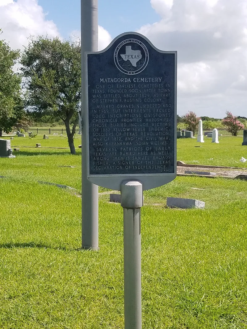
Matagorda Cemetery occupies 7.29 acres of flat Gulf Coast prairie at the northeast edge of the town of Matagorda, Texas. The first known burials, in 1830, were Esther Randall Wightman and her husband Benjamin, parents of town founder Elias R. Wightman. The town proprietors formally set the ground aside as a public cemetery in 1833. Today it holds more than 1,255 known graves, and an estimated 350 more may be unmarked. Shell-paved drives divide it into sections A through E; section A was reserved for African American and Hispanic residents. Markers include marble tablets, Victorian tabernacle monuments, obelisks, crypts, folk-made pieces and four 1936 Texas Centennial markers. Storms, especially the 1942 hurricane, destroyed much of the town, leaving the cemetery as its best-preserved historic resource. Its graves include veterans of several wars, victims of epidemics, and figures from the Republic of Texas. The period of significance ends in 1955.
Significance in brief: The cemetery is the only surviving publicly owned historic resource in Matagorda that retains its integrity. Its burials record the town's role as an early point of entry into Texas and as a seat of county government, and include men important in the Texas Revolution and the Republic of Texas. Its markers also show 19th to mid-20th century commemorative practices and the racial, ethnic and social mix of the community.
Machine-generated summary. This summary was generated by a language model from the official nomination document and has not been reviewed line by line by an editor. It may contain errors. Check the source document before relying on any detail. Source: nomination document (PDF) · National Archives catalog entry. NRHP reference 06000511, listed June 15, 2006. Summary generated October 2026 (model claude-sonnet-5-5, prompt v1.0-2026-10-29, confidence medium).
Key facts
| Address | Jct. of TX 60 at Matagorda Cty Rds 259 and 260, Matagorda |
|---|---|
| County | Matagorda County |
| Listed | June 15, 2006 |
| Reference number | 06000511 |
| Resource type | District |
| Period of significance | 1830-1955 |
| Areas of significance | Exploration/Settlement, Community Planning and Development |
| Level of significance | Local |
| Status (as stated in the nomination) | Still in use as a cemetery and described as well maintained and in good condition, with a high degree of integrity. Hurricanes have damaged markers and fencing over time. |
| Acreage | 7.3 |
| Coordinates | 28.70312, -95.95584 (NPS GIS) |
What listing means for this property
This is a historic district. Buildings within its boundary are either contributing (they add to the district's significance) or non-contributing. Owners of contributing income-producing buildings can claim the 20% federal rehabilitation tax credit; homeowners should look at state credits. National Register districts impose no design review by themselves; a local historic district ordinance, if one exists, does (the difference explained).
General information, not legal or tax advice. Rules change; confirm with your State Historic Preservation Office or a qualified adviser.
Sources and further reading
- National Park Service, National Register of Historic Places database (snapshot May 2026), reference 06000511.
- Nomination form (PDF, National Archives) — catalog entry
- Wikidata Q109999829
- This listing as JSON
Last updated October 2026. Found an error? See the editorial policy for how to report it.