Houston Heights Waterworks Reservoir

Why it's listed
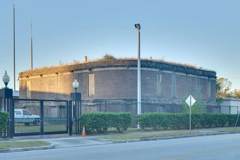
This one-story reservoir at West 20th and Nicolson Streets in Houston was built between 1893 and 1895 as part of the Houston Heights waterworks. It is a square structure of brown brick with rounded corners, banded by stringcourses of gray concrete at the base and about six feet above ground, and of tan brick near the top. Each side carries two blind windows, and the flat roof is covered with grass and sod. It occupies a one-acre corner lot between railroad tracks and a commercial area. The reservoir is the only original structure remaining from the Heights waterworks. O. M. Carter developed it to supply water to residents moving into his new town, which makes it a physical reminder of the community's planned beginnings. Accounts say the grounds around it were once kept like a park. It is recorded as being in good condition and is still used as a reservoir, and its significance is rated as local in the area of community planning.
Significance in brief: It is the only remaining original structure from the Heights waterworks. O. M. Carter developed it to provide water service for residents moving into his new town. The form cites community planning as its area of significance at the local level.
Machine-generated summary. This summary was generated by a language model from the official nomination document and has not been reviewed line by line by an editor. It may contain errors. Check the source document before relying on any detail. Source: nomination document (PDF) · National Archives catalog entry. NRHP reference 83004462, listed June 22, 1983. Summary generated October 2026 (model claude-sonnet-5-5, prompt v1.0-2026-10-29, confidence medium).
Key facts
| Address | W. 20 and Nicolson Sts., Houston |
|---|---|
| County | Harris County |
| Listed | June 22, 1983 |
| Reference number | 83004462 |
| Resource type | Building |
| Period of significance | 1800-1899 |
| Areas of significance | Community Planning and Development |
| Level of significance | Local |
| Status (as stated in the nomination) | Described as in good condition and still used as a reservoir; site is original, with no alterations reported in one record, while an earlier record notes blocked-up openings. |
| Acreage | 1 |
| Coordinates | 29.80435, -95.40666 (NPS GIS) |
What listing means for this property
National Register listing is honorary: it recognises significance and does not restrict what a private owner may do without federal money or permits. It unlocks the 20% federal rehabilitation tax credit for income-producing buildings, state credits in many states, and Section 106 review when federal agencies are involved. See what listing means in practice.
General information, not legal or tax advice. Rules change; confirm with your State Historic Preservation Office or a qualified adviser.
Sources and further reading
- National Park Service, National Register of Historic Places database (snapshot May 2026), reference 83004462.
- Nomination form (PDF, National Archives) — catalog entry
- Wikipedia article (used for cross-checking only; text not reproduced here)
- Wikidata Q19880350
- This listing as JSON
Last updated October 2026. Found an error? See the editorial policy for how to report it.