Bluff Dale Suspension Bridge

Why it's listed
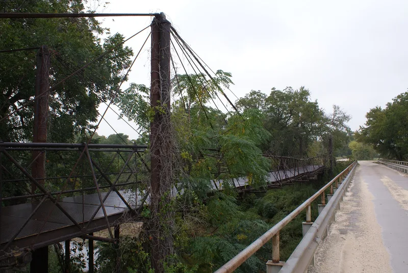
This suspension bridge crosses the Paluxy River on Berry's Creek Road at Bluff Dale in Erath County, Texas. Built about 1895, it originally stood on an old road that later became State Highway 10 and then US 377. When a wider bridge replaced it in 1933, the county precinct moved the old structure in 1934 to a crossing 1½ miles upstream, adding 25-foot extensions at each end to suit the river's width there. The bridge measures about 11 by 225 feet, with seven 1-inch cables along each side, 9-inch iron pipes, steel girders and a lumber deck with two tire runners. It was Bluff Dale's first permanent bridge, built as the community grew after the railroad arrived in 1889. It is described as Erath County's earliest recorded bridge and one of few remaining suspension bridges in Texas. It remains in use, though the form notes deterioration from lack of maintenance and a nearby low-water bridge now serves heavy trucks.
Significance in brief: The nomination calls it Erath County's earliest recorded bridge and one of the few remaining suspension bridges in Texas. It was Bluff Dale's first permanent bridge, giving an all-weather crossing on the route toward Fort Worth after the railroad arrived in 1889.
Machine-generated summary. This summary was generated by a language model from the official nomination document and has not been reviewed line by line by an editor. It may contain errors. Check the source document before relying on any detail. Source: nomination document (PDF) · National Archives catalog entry. NRHP reference 77001440, listed December 20, 1977. Summary generated October 2026 (model claude-sonnet-5-5, prompt v1.0-2026-10-29, confidence medium).
Key facts
| Address | County Rd. 149 (Berry's Creek Rd.) at Paluxy River, Bluff Dale |
|---|---|
| County | Erath County |
| Listed | December 20, 1977 |
| Reference number | 77001440 |
| Resource type | Structure |
| Period of significance | 1895 |
| Areas of significance | Engineering, Transportation |
| Level of significance | State |
| Status (as stated in the nomination) | Still in use, but described as deteriorating from lack of county maintenance, with parts of the roadway needing replacement. |
| Acreage | 1 |
| Coordinates | 32.35429, -98.02598 (NPS GIS) |
What listing means for this property
For a publicly owned building or structure, listing mainly matters when federal funds, permits or licences are involved: projects then go through Section 106 review so effects on the property are considered. Listing also strengthens applications for preservation grants and, for leased income-producing uses, can enable the federal rehabilitation tax credit.
General information, not legal or tax advice. Rules change; confirm with your State Historic Preservation Office or a qualified adviser.
Sources and further reading
- National Park Service, National Register of Historic Places database (snapshot May 2026), reference 77001440.
- Nomination form (PDF, National Archives) — catalog entry
- Wikipedia article (used for cross-checking only; text not reproduced here)
- Wikidata Q4930642
- This listing as JSON
Last updated October 2026. Found an error? See the editorial policy for how to report it.