Rancho Estelle
Also known as: Sublett Farm; Stone Residence; Dorgan Residence
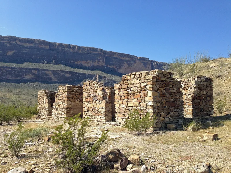

Why it's listed
Rancho Estelle is a cluster of ruined farm buildings on the north side of Park Route 9 in Big Bend National Park, between Castalon and Santa Elena Canyon. James Sublett, an early large-scale farmer of the Rio Grande flood plain, bought four sections of land here and, as Grand Canyon Farms, he and his associates operated the farm. The surviving structures include an adobe farmhouse, a farm hand's casita, an adobe shed, a stone farmhouse that probably housed workers, and the Dorgan Residence. The Dorgan house is a one-story adobe and stone home with a large square main room, a two-way petrified wood fireplace serving as a structural pier, and log beams forming a nearly flat hipped roof. All of the buildings are roofless or deteriorating. The site was listed for its value in showing flood plain farming along the Rio Grande and for the architectural merit of the Dorgan house.
Significance in brief: The nomination argues that Rancho Estelle is a good, representative example of flood plain farming along the Rio Grande. It also states that the Dorgan House has outstanding architectural merit among remaining structures of its time, type and place.
Machine-generated summary. This summary was generated by a language model from the official nomination document and has not been reviewed line by line by an editor. It may contain errors. Check the source document before relying on any detail. Source: nomination document (PDF) · National Archives catalog entry. NRHP reference 74000280, listed September 3, 1974. Summary generated October 2026 (model claude-sonnet-5-5, prompt v1.0-2026-10-29, confidence medium).
Key facts
| Address | On the Rio Grande River, Big Bend National Park |
|---|---|
| County | Brewster County |
| Listed | September 3, 1974 |
| Reference number | 74000280 |
| Resource type | District |
| Period of significance | Early 1900's |
| Areas of significance | Agriculture, Architecture |
| Level of significance | Local |
| Status (as stated in the nomination) | All remaining structures are in various states of ruin; some stabilization work has been done, but all are endangered. The form checks the condition as ruins and proposes preservation. |
| Acreage | 135 |
| Coordinates | 29.15460, -103.57923 (NPS GIS) |
What listing means for this property
This is a historic district. Buildings within its boundary are either contributing (they add to the district's significance) or non-contributing. Owners of contributing income-producing buildings can claim the 20% federal rehabilitation tax credit; homeowners should look at state credits. National Register districts impose no design review by themselves; a local historic district ordinance, if one exists, does (the difference explained).
General information, not legal or tax advice. Rules change; confirm with your State Historic Preservation Office or a qualified adviser.
Sources and further reading
- National Park Service, National Register of Historic Places database (snapshot May 2026), reference 74000280.
- Nomination form (PDF, National Archives) — catalog entry
- Wikipedia article (used for cross-checking only; text not reproduced here)
- Wikidata Q7290973
- This listing as JSON
Last updated October 2026. Found an error? See the editorial policy for how to report it.