Aransas Pass Light Station

Why it's listed
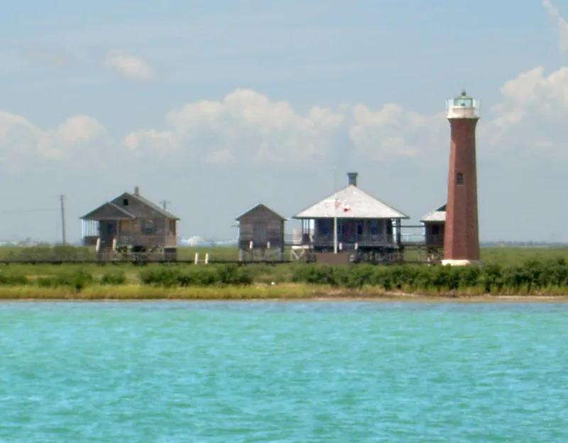
Aransas Pass Light Station occupies roughly 24 acres of low marsh on Harbor Island, beside the Lydia Ann Channel near Port Aransas, Texas. Completed in 1857 by the U.S. Lighthouse Board, it centers on an octagonal brick tower with a fourth-order Fresnel lens, and it grew to include tile-and-stucco and wood-frame keepers' dwellings, a radio room, raised plank walks, a T-head wharf and cypress cisterns. Hurricanes in 1916, 1919 and 1970 destroyed or damaged several structures, and Confederate soldiers blew the top off the tower in 1862; it was repaired and relit in 1867. The light guided shipping until 1952. The station is listed as the second oldest surviving lighthouse on the Texas coast, and it remains largely intact. Only the oil house and the radio beacon tower are gone. The tower and stairway were restored in 1972, and the buildings are in residential use today.
Significance in brief: The station is the second oldest surviving lighthouse on the Texas coast and served until 1952, much longer than Point Isabel. It survives almost as it was in its active years, with only the oil house and radio beacon tower gone. Its tower also figured in Civil War events, when Confederate soldiers blew off its top in 1862.
Machine-generated summary. This summary was generated by a language model from the official nomination document and has not been reviewed line by line by an editor. It may contain errors. Check the source document before relying on any detail. Source: nomination document (PDF) · National Archives catalog entry. NRHP reference 77001423, listed August 3, 1977. Summary generated October 2026 (model claude-sonnet-5-5, prompt v1.0-2026-10-29, confidence medium).
Key facts
| Address | N of Port Aransas on Harbor Island, Port Aransas |
|---|---|
| County | Aransas County |
| Listed | August 3, 1977 |
| Reference number | 77001423 |
| Resource type | District |
| Period of significance | 1857 - 1952 |
| Architect / builder | U.S. Lighthouse Board |
| Areas of significance | Commerce, Engineering, Transportation |
| Level of significance | State |
| Status (as stated in the nomination) | Light went out of service in 1952. The station is now used as a private residence, with the tower restored in 1972; the oil house was destroyed by Hurricane Celia in 1970. |
| Acreage | 23.8 |
| Coordinates | 27.86364, -97.05645 (NPS GIS) |
What listing means for this property
This is a historic district. Buildings within its boundary are either contributing (they add to the district's significance) or non-contributing. Owners of contributing income-producing buildings can claim the 20% federal rehabilitation tax credit; homeowners should look at state credits. National Register districts impose no design review by themselves; a local historic district ordinance, if one exists, does (the difference explained).
General information, not legal or tax advice. Rules change; confirm with your State Historic Preservation Office or a qualified adviser.
Sources and further reading
- National Park Service, National Register of Historic Places database (snapshot May 2026), reference 77001423.
- Nomination form (PDF, National Archives) — catalog entry
- Wikipedia article (used for cross-checking only; text not reproduced here)
- Wikidata Q18619035
- This listing as JSON
Last updated October 2026. Found an error? See the editorial policy for how to report it.