Mingo Creek Presbyterian Church and Churchyard

Why it's listed
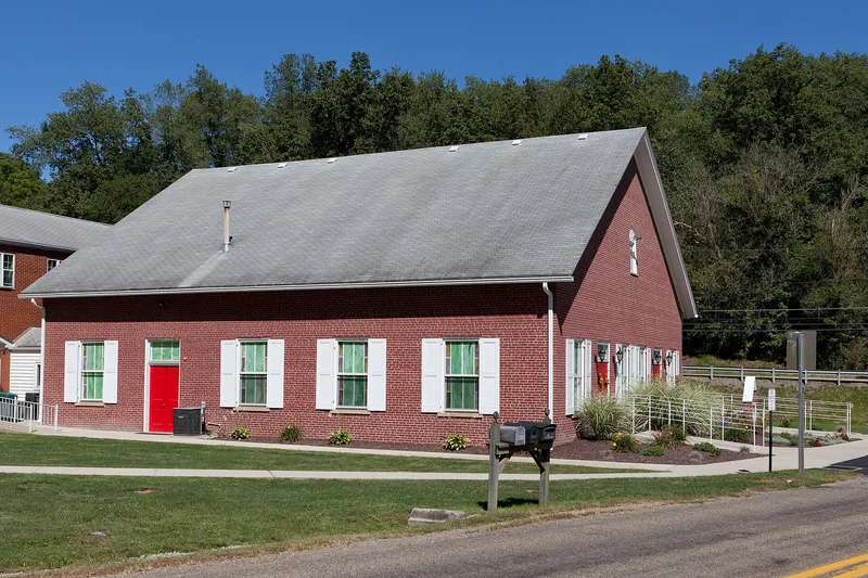
Built in 1831 in Courtney, Washington County, this one-and-a-half-story brick church sits north of Mingo Church Road on a site where congregations have gathered since the late 1780s. Its churchyard holds the graves of six men involved in the Whiskey Rebellion of 1794, among them Captain James McFarlane, who was killed at the home of excise inspector Neville and whose tombstone was placed in 1798. During the summer of 1794 the grounds hosted militia musters, a Democratic Society founded on February 28 of that year, and a large July assembly that drew former rioters and local leaders into open protest. Many key rebel participants lived in the surrounding township. Because of these events, the property is regarded as a regional center of the uprising, and its oldest cemetery sections are significant for their early stones and graves. A 1924 manse and a 1958 education building are counted as noncontributing.
Significance in brief: The site is argued to have been the political and social center of its community and a regional nerve center during the Whiskey Rebellion of 1794. Militia and Democratic Society meetings took place there, and the churchyard holds graves of rebel participants, including Captain James McFarlane, who was killed during the uprising. The cemetery's oldest sections are also treated as significant in their own right.
Machine-generated summary. This summary was generated by a language model from the official nomination document and has not been reviewed line by line by an editor. It may contain errors. Check the source document before relying on any detail. Source: nomination document (PDF) · National Archives catalog entry. NRHP reference 92001500, listed November 12, 1992. Summary generated October 2026 (model claude-haiku-5-5, prompt v1.1-2026-10-29, confidence high).
Key facts
| Address | Jct. of PA 88 and Mingo Church Rd., Union Township, Courtney |
|---|---|
| County | Washington County |
| Listed | November 12, 1992 |
| Reference number | 92001500 |
| Resource type | Site |
| Period of significance | 1793-1837 |
| Architectural style | vernacular |
| Criteria |
|
| Areas of significance | Politics/Government |
| Level of significance | Local |
| Acreage | 3 |
| Coordinates | 40.22901, -79.99692 (NPS GIS) |
What listing means for this property
Sites (archaeological sites, battlefields, landscapes) are often listed with a restricted address to protect them from looting or disturbance. Listing is honorary for private owners; federal undertakings on or near the site go through Section 106 review, and state laws may protect burials and artefacts regardless of listing.
General information, not legal or tax advice. Rules change; confirm with your State Historic Preservation Office or a qualified adviser.
Sources and further reading
- National Park Service, National Register of Historic Places database (snapshot May 2026), reference 92001500.
- Nomination form (PDF, National Archives) — catalog entry
- Wikipedia article (used for cross-checking only; text not reproduced here)
- Wikidata Q6864765
- This listing as JSON
Last updated October 2026. Found an error? See the editorial policy for how to report it.