Boswell Historic District

Why it's listed
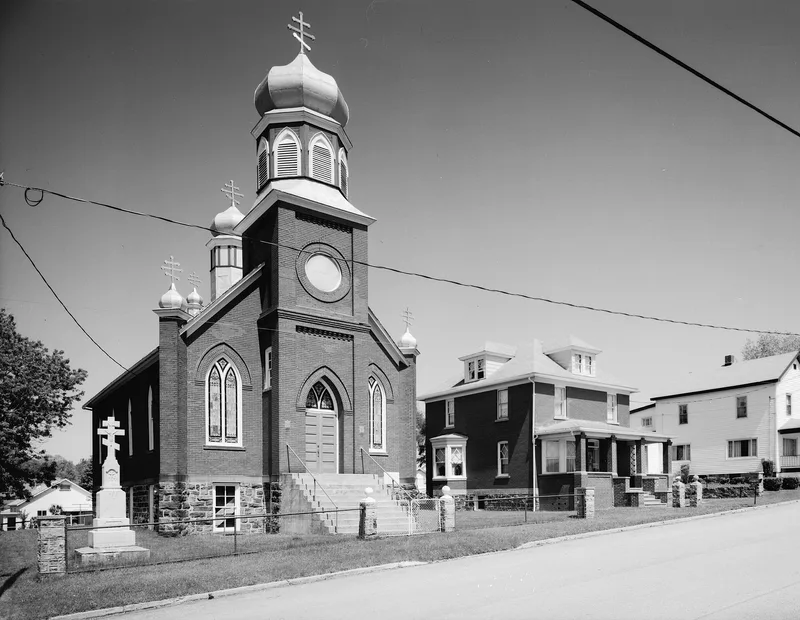
Boswell was laid out in 1901 by the Merchants Coal Company of Baltimore on a forty-five degree grid of 50 by 120 foot lots in Jenner Township, Somerset County. The company built miners' and managers' houses, a company store, an office and a bank, and donated land for churches and a school. Private investors bought many lots and built homes and businesses, so the town was only partly company-controlled. The district keeps two surviving mine buildings, the 1901 powerhouse and the pump house, along with archaeological remains of the mine's machine shop, blacksmith shop and mule barn. The mine, known for its Orenda coal, operated until 1939. Boswell miners joined the United Mine Workers strike of April 1, 1922, shutting down Orenda Mine No. 2. The district is noted for its integrity of setting and its illustration of coal town planning in the region.
Significance in brief: The nomination argues the district is a well-preserved example of a company-planned coal town built in southwestern Pennsylvania during the first four decades of the 20th century. It is significant for its link to the bituminous coal industry, for its company town planning and paternalism, for its connection to the 1922 UMWA strike, for its contributing industrial, vernacular and institutional architecture, and for archaeological remains of the mine.
Machine-generated summary. This summary was generated by a language model from the official nomination document and has not been reviewed line by line by an editor. It may contain errors. Check the source document before relying on any detail. Source: nomination document (PDF) · National Archives catalog entry. NRHP reference 94000519, listed June 3, 1994. Summary generated October 2026 (model claude-haiku-5-5, prompt v1.1-2026-10-29, confidence medium).
Key facts
| Address | Roughly bounded by Hower Ave., Atkinson Way, Quemahoning Creek, Main St. and Juniata St., Boswell |
|---|---|
| County | Somerset County |
| Listed | June 3, 1994 |
| Reference number | 94000519 |
| Resource type | District |
| Period of significance | 1901-1939 |
| Architect / builder | Hower, Charles E., Myton, Walter, Vickroy, William (listed as significant persons); Merchants Coal Company founded the town and Charles E. Hower and W.H. Morris laid out the mine. |
| Architectural style | Late Victorian; Late 19th and 20th Century Revivals/Colonial Revival; vernacular with a few Italian Renaissance and Colonial Revival examples |
| Criteria |
|
| Areas of significance | Historic - Non-Aboriginal, Architecture, Social History, Community Planning and Development, Industry |
| Level of significance | State |
| Status (as stated in the nomination) | The former powerhouse is occupied by an equipment repair and sales business, and the pump house is deteriorating and abandoned. |
| Acreage | 80 |
| Coordinates | 40.16220, -79.02804 (NPS GIS) |
What listing means for this property
This is a historic district. Buildings within its boundary are either contributing (they add to the district's significance) or non-contributing. Owners of contributing income-producing buildings can claim the 20% federal rehabilitation tax credit; homeowners should look at state credits. National Register districts impose no design review by themselves; a local historic district ordinance, if one exists, does (the difference explained).
General information, not legal or tax advice. Rules change; confirm with your State Historic Preservation Office or a qualified adviser.
Sources and further reading
- National Park Service, National Register of Historic Places database (snapshot May 2026), reference 94000519.
- Nomination form (PDF, National Archives) — catalog entry
- Wikipedia article (used for cross-checking only; text not reproduced here)
- Wikidata Q4948332
- This listing as JSON
Last updated October 2026. Found an error? See the editorial policy for how to report it.