Austin Dam
Also known as: Bayless Paper Company Dam

Why it's listed
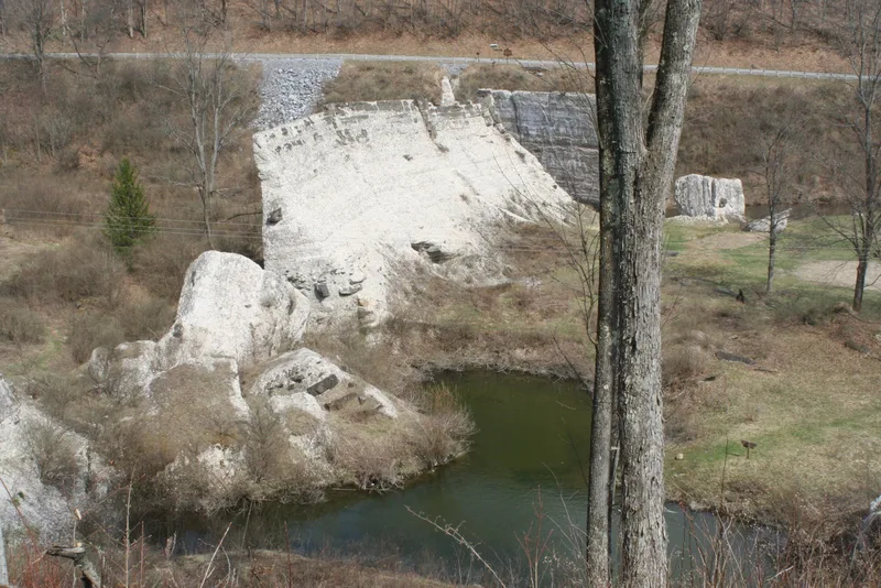
Concrete ruins of a dam on Freeman Run north of Austin, Pennsylvania, built in 1909 for the Bayless Pulp and Paper Company to supply water to its paper mill. Designed by sanitary and hydraulic engineer T. Chalkley Hatton of Wilmington, Delaware, the structure stood about forty-six feet high and 534 feet long. Cracks and a January 1910 structural failure foreshadowed disaster. On September 30, 1911, the dam broke after heavy rains, releasing a flood that destroyed mills and hundreds of homes in Austin and killed seventy-eight people. Investigations blamed the thin wall, a weak sandstone foundation and an unstepped base. The disaster prompted the Pennsylvania Water Supply Commission to press for inspection powers, which the 1913 law granted, establishing the state's first effective dam safety regulation. The remaining sections are visible from the roadway.
Significance in brief: The nomination argues the dam is significant for the flood its 1911 failure caused, which killed seventy-eight people, and for the legislation that followed. The failure is described as the impetus for Pennsylvania's first state law permitting effective regulation and inspection of dam construction, passed in 1913.
Machine-generated summary. This summary was generated by a language model from the official nomination document and has not been reviewed line by line by an editor. It may contain errors. Check the source document before relying on any detail. Source: nomination document (PDF) · National Archives catalog entry. NRHP reference 86003570, listed January 15, 1987. Summary generated October 2026 (model claude-haiku-5-5, prompt v1.1-2026-10-29, confidence high).
Key facts
| Address | PA 872, Austin |
|---|---|
| County | Potter County |
| Listed | January 15, 1987 |
| Reference number | 86003570 |
| Resource type | Site |
| Period of significance | 1900- |
| Architect / builder | Rommell - T. Chalkley Hatton |
| Areas of significance | Politics/Government |
| Level of significance | State |
| Status (as stated in the nomination) | Ruins; the dam is broken into sections, with five upright and two large sections toppled. |
| Acreage | 1.3 |
| Coordinates | 41.64060, -78.08793 (NPS GIS) |
What listing means for this property
Sites (archaeological sites, battlefields, landscapes) are often listed with a restricted address to protect them from looting or disturbance. Listing is honorary for private owners; federal undertakings on or near the site go through Section 106 review, and state laws may protect burials and artefacts regardless of listing.
General information, not legal or tax advice. Rules change; confirm with your State Historic Preservation Office or a qualified adviser.
Sources and further reading
- National Park Service, National Register of Historic Places database (snapshot May 2026), reference 86003570.
- Nomination form (PDF, National Archives) — catalog entry
- Wikipedia article (used for cross-checking only; text not reproduced here)
- Wikidata Q780872
- This listing as JSON
Last updated October 2026. Found an error? See the editorial policy for how to report it.