Fort Mifflin
Also known as: Mud Island Fort; Old Fort Mifflin
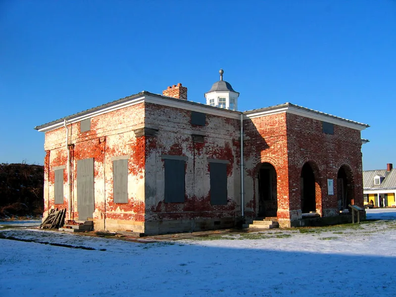

Why it's listed
Fort Mifflin occupies Mud Island in the Delaware River at Philadelphia, and its buildings were added in several phases from 1772 onward. The surviving stone river wall, laid in the eighteenth century, was regarded as notable for its masonry and for its role in the siege of October-November 1777. The Commandant's House, a pilastered brick building probably begun in 1794, is attributed to Pierre Charles L'Enfant, who worked at the fort in the early 1790s. The 1814 Officers' Quarters has a double gallery facing the parade ground with cast iron grillwork and turned wooden columns. The artillery shed of about 1837 is described as a rare surviving example of its building type. Its engineers included several French officers who had served with Lafayette or emigrated after the Revolution.
Significance in brief: The fort's building phases correspond with major periods of the nation's history, from the 1770s through the twentieth century. Its surviving eighteenth-century stone river wall, its early nineteenth-century buildings and its association with L'Enfant and other French engineers are presented as important both historically and architecturally.
Machine-generated summary. This summary was generated by a language model from the official nomination document and has not been reviewed line by line by an editor. It may contain errors. Check the source document before relying on any detail. Source: nomination document (PDF) · National Archives catalog entry. NRHP reference 70000554, listed August 29, 1970. Summary generated October 2026 (model claude-haiku-5-5, prompt v1.1-2026-10-29, confidence medium).
Key facts
| Address | Marina and Penrose Ferry Rds., Philadelphia |
|---|---|
| County | Philadelphia |
| Listed | August 29, 1970 |
| Reference number | 70000554 |
| Resource type | District |
| Period of significance | 1772-1900 |
| Architect / builder | Captain John Montresor (chief engineer, first phase); Pierre Charles L'Enfant (1794 phase, probable designer of the Commandant's House) |
| Areas of significance | Military, Engineering |
| Level of significance | National |
| National Historic Landmark | Yes, designated August 29, 1970 |
| Status (as stated in the nomination) | Described as deteriorated in its condition at the time of nomination. |
| Coordinates | 39.87277, -75.21463 (NPS GIS) |
What listing means for this property
This is a historic district. Buildings within its boundary are either contributing (they add to the district's significance) or non-contributing. Owners of contributing income-producing buildings can claim the 20% federal rehabilitation tax credit; homeowners should look at state credits. National Register districts impose no design review by themselves; a local historic district ordinance, if one exists, does (the difference explained).
General information, not legal or tax advice. Rules change; confirm with your State Historic Preservation Office or a qualified adviser.
Sources and further reading
- National Park Service, National Register of Historic Places database (snapshot May 2026), reference 70000554.
- Nomination form (PDF, National Archives) — catalog entry
- Wikipedia article (used for cross-checking only; text not reproduced here)
- Wikidata Q3077947
- This listing as JSON
Last updated October 2026. Found an error? See the editorial policy for how to report it.