Lehigh Canal

Why it's listed
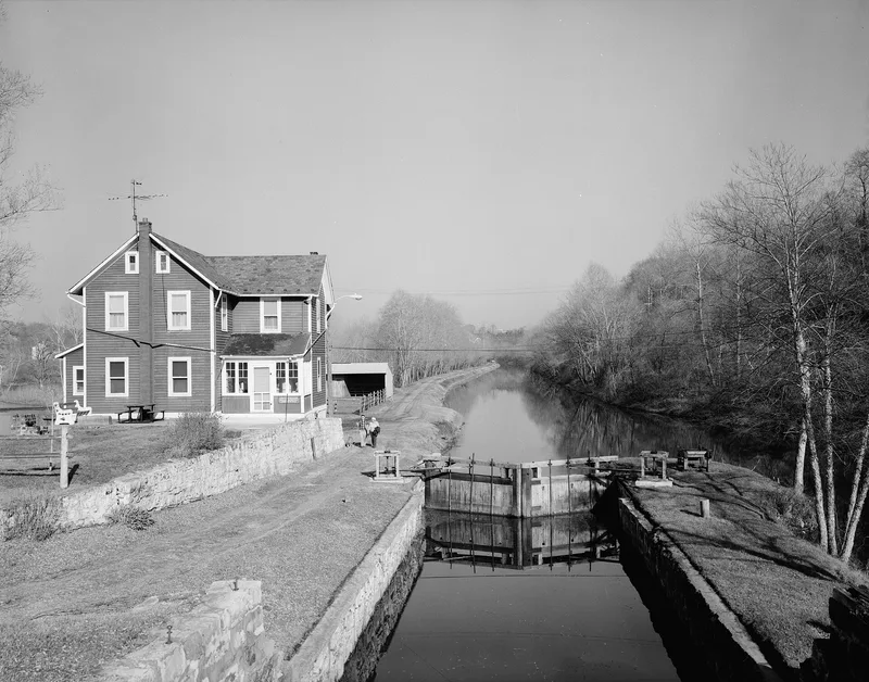
The Lehigh Canal, a navigation waterway along the Lehigh River in eastern Pennsylvania, was begun in 1818 to carry anthracite coal from the Mauch Chunk area to market. Construction of the lower sections started in 1827 under the supervision of engineer Canvass White, and regular coal shipments began within two years. The Walnutport section between Lehigh Gap and Walnutport includes seven locks, a guard lock and a dam, along with 3.77 miles of canal bed and towpath. Locks 23 and 24 stand in the town of Walnutport, and the canal bed there is water-filled. The town itself grew from the canal and was once the centre of a canal boat building and repair industry. Commercial traffic on the canal ended in 1931, after the Lehigh Navigation and Coal Company ceased to make a profit. The section was nominated for its association with the coal transport industry and the canal's role in shaping towns along the river, and its relatively intact physical remains.
Significance in brief: The canal was built to carry anthracite coal from the Mauch Chunk area to market, and the nomination argues it shaped the industry and settlement of the Lehigh River valley. The Walnutport section is described as having a canal boat building and repair industry centred on the town. The nomination describes the section as one of the best preserved stretches of the canal.
Machine-generated summary. This summary was generated by a language model from the official nomination document and has not been reviewed line by line by an editor. It may contain errors. Check the source document before relying on any detail. Source: nomination document (PDF) · National Archives catalog entry. NRHP reference 78002439, listed October 2, 1978. Summary generated October 2026 (model claude-haiku-5-5, prompt v1.1-2026-10-29, confidence medium).
Key facts
| Address | Lehigh Gap to S Walnutport boundary, Walnutport |
|---|---|
| County | Northampton County |
| Listed | October 2, 1978 |
| Reference number | 78002439 |
| Resource type | District |
| Period of significance | 1800-1899 |
| Architect / builder | Canvass White (engineer); Josiah White (preliminary survey and engineering) |
| Areas of significance | Industry, Commerce, Historic - Non-Aboriginal, Engineering, Transportation |
| Level of significance | State |
| Status (as stated in the nomination) | Walnutport section: Lock 22 and Dam #3 are in poor condition; Lock 24 is the best preserved; Lock 25 is deteriorated; canal bed and towpath are largely water-filled and cleared. |
| Acreage | 241.3 |
| Coordinates | 40.76011, -75.60769 (NPS GIS) |
What listing means for this property
This is a historic district. Buildings within its boundary are either contributing (they add to the district's significance) or non-contributing. Owners of contributing income-producing buildings can claim the 20% federal rehabilitation tax credit; homeowners should look at state credits. National Register districts impose no design review by themselves; a local historic district ordinance, if one exists, does (the difference explained).
General information, not legal or tax advice. Rules change; confirm with your State Historic Preservation Office or a qualified adviser.
Sources and further reading
- National Park Service, National Register of Historic Places database (snapshot May 2026), reference 78002439.
- Nomination form (PDF, National Archives) — catalog entry
- Wikipedia article (used for cross-checking only; text not reproduced here)
- Wikidata Q1813103
- This listing as JSON
Last updated October 2026. Found an error? See the editorial policy for how to report it.