Central Norristown Historic District
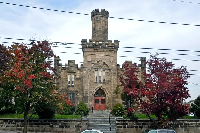

Why it's listed
Norristown's central district lies on a hill and valleys north of the Schuylkill River and combines the Montgomery County courthouse square, the borough's Main Street business district, mills, churches and housing in one connected area of roughly forty blocks. Its development follows county government from 1784, when the county was formed and a 27 1/2 acre seat was set aside, and the borough's growth after its 1812 incorporation. Industry grew along Stoney Creek and Saw Mill Run, served by the Schuylkill Canal, the Reading Railroad and trolley lines from the 1880s. The district holds Greek Revival houses, Italianate villas and rows, and late Victorian mansions, including the 1849 Corson-Highly House and the 1893 McInnes House. Its architecture is cited as evidence of the town's economic and ethnic diversity, and the district's buildings have largely kept their original form.
Significance in brief: The district is presented as an intact example of a 19th and early 20th-century Pennsylvania industrial county seat, combining county government, a borough business district, industry, and varied residential neighborhoods. Its architectural diversity is said to reflect the town's economic, ethnic and social diversity, and its architectural integrity is described as a key part of its importance.
Machine-generated summary. This summary was generated by a language model from the official nomination document and has not been reviewed line by line by an editor. It may contain errors. Check the source document before relying on any detail. Source: nomination document (PDF) · National Archives catalog entry. NRHP reference 84000321, listed November 23, 1984. Summary generated October 2026 (model claude-haiku-5-5, prompt v1.1-2026-10-29, confidence medium).
Key facts
| Address | Roughly bounded by Stoney Creek, Walnut, Lafayette, and Fornace Sts., Norristown |
|---|---|
| County | Montgomery County |
| Listed | November 23, 1984 |
| Reference number | 84000321 |
| Resource type | District |
| Period of significance | 1800-1920 |
| Architectural style | Federal; Greek Revival; Italianate; Victorian styles including Shingle Style, Queen Anne and Beaux-Arts; Georgian Revival |
| Criteria |
|
| Areas of significance | Industry, Commerce, Politics/Government, Architecture |
| Level of significance | Local |
| Status (as stated in the nomination) | The form describes the district as having survived the 20th century relatively intact, with some vacant lots in the central business district. |
| Acreage | 245 |
| Coordinates | 40.12053, -75.33854 (NPS GIS) |
What listing means for this property
This is a historic district. Buildings within its boundary are either contributing (they add to the district's significance) or non-contributing. Owners of contributing income-producing buildings can claim the 20% federal rehabilitation tax credit; homeowners should look at state credits. National Register districts impose no design review by themselves; a local historic district ordinance, if one exists, does (the difference explained).
General information, not legal or tax advice. Rules change; confirm with your State Historic Preservation Office or a qualified adviser.
Sources and further reading
- National Park Service, National Register of Historic Places database (snapshot May 2026), reference 84000321.
- Nomination form (PDF, National Archives) — catalog entry
- Wikipedia article (used for cross-checking only; text not reproduced here)
- Wikidata Q5061521
- This listing as JSON
Last updated October 2026. Found an error? See the editorial policy for how to report it.