Saltsburg Historic District

Why it's listed
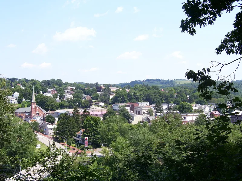
Saltsburg's historic district covers about 48 acres of the oldest part of the borough, a crescent of streets fronting on or west of Salt Street. Most of its 118 contributing buildings are wood frame, with some brick and stone, and they date from the 1820s through the 1930s. The town grew after the Pennsylvania Canal opened through it in 1829, with Lock No. 8 at the end of Salt Street, and many canal-era dwellings and stores were oriented toward the waterway, which served as a second main street. The Western Pennsylvania Railroad arrived along Plum and Walnut Alleys in the 1860s and was moved to the old towpath in 1882, prompting an 1880s building boom that replaced some canal-era construction with Victorian buildings of similar scale. Commercial and industrial activity, including salt production, coal and milling, shaped the town's economy. Archaeological excavations of Lock No. 8 in 1990 located remnants of the lock structure, which is why the district is regarded as important for canal history.
Significance in brief: The district is significant in transportation, architecture, commerce and archaeology. It developed around the Pennsylvania Canal (opened 1829) and the later railroad, and its canal-era and railroad-era buildings form a largely intact vernacular townscape. Excavated remnants of Lock No. 8 are regarded as able to yield information on canal construction and technology.
Machine-generated summary. This summary was generated by a language model from the official nomination document and has not been reviewed line by line by an editor. It may contain errors. Check the source document before relying on any detail. Source: nomination document (PDF) · National Archives catalog entry. NRHP reference 92000386, listed May 7, 1992. Summary generated October 2026 (model claude-haiku-5-5, prompt v1.1-2026-10-29, confidence high).
Key facts
| Address | Roughly, W of Plum and Walnut Alleys to Kiskiminetas R., Saltsburg |
|---|---|
| County | Indiana County |
| Listed | May 7, 1992 |
| Reference number | 92000386 |
| Resource type | District |
| Period of significance | 1829-1941 |
| Architectural style | Early Republican/Federal; Other/Canal Vernacular; Late Victorian/Italianate; Late Victorian/Queen Anne/Eastlake; Late 19th & 20th Century Revivals/Classical Revival; Late 19th & Early 20th Century Movements/Commercial Style; Late 19th & Early 20th Century Movements/Bungalow; Other/Late 19th & Early 20th Century Vernacular |
| Criteria |
|
| Areas of significance | Commerce, Historic - Non-Aboriginal, Transportation, Architecture |
| Level of significance | Local |
| Status (as stated in the nomination) | Commercial uses concentrated on Salt and Point Streets; the Borough maintains the former canal bed as Canal Park; 29 buildings of new construction since the early 1950s are non-contributing. |
| Acreage | 48 |
| Coordinates | 40.48617, -79.45188 (NPS GIS) |
What listing means for this property
This is a historic district. Buildings within its boundary are either contributing (they add to the district's significance) or non-contributing. Owners of contributing income-producing buildings can claim the 20% federal rehabilitation tax credit; homeowners should look at state credits. National Register districts impose no design review by themselves; a local historic district ordinance, if one exists, does (the difference explained).
General information, not legal or tax advice. Rules change; confirm with your State Historic Preservation Office or a qualified adviser.
Sources and further reading
- National Park Service, National Register of Historic Places database (snapshot May 2026), reference 92000386.
- Nomination form (PDF, National Archives) — catalog entry
- Wikipedia article (used for cross-checking only; text not reproduced here)
- Wikidata Q7406199
- This listing as JSON
Last updated October 2026. Found an error? See the editorial policy for how to report it.