Robertsdale Historic District

Why it's listed
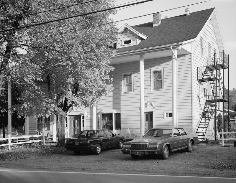
Robertsdale is a coal company town on the east side of Broad Top Mountain in southwest Huntingdon County, laid out in 1873 by the Rockhill Iron and Coal Company. Most of its roughly 95 surviving company houses date from about 1873 to 1925 and are mostly semi-detached wood frame buildings set at the front of long narrow lots. The town also includes a company store built in 1873-4 of local buff stone, a cast stone company office of about 1914, a 1914 cast stone depot, a hotel, a school and a theatre. The company controlled the land, the store and the railroad that carried coal to Mt. Union, and it used restrictive covenants in leases and deeds to limit union activity. The town is regarded as a representative example of a Pennsylvania coal patch town, and its mine site holds remains that could inform study of mining methods.
Significance in brief: The district is argued to be a typical Pennsylvania coal patch town with company-built housing, a company store and office, and an intact concentration of mining town architecture. Its mine site retains structural remains with potential to yield archaeological information on mining operations. It is also linked to the East Broad Top Railroad, which is described as a National Landmark.
Machine-generated summary. This summary was generated by a language model from the official nomination document and has not been reviewed line by line by an editor. It may contain errors. Check the source document before relying on any detail. Source: nomination document (PDF) · National Archives catalog entry. NRHP reference 92000391, listed May 7, 1992. Summary generated October 2026 (model claude-haiku-5-5, prompt v1.1-2026-10-29, confidence high).
Key facts
| Address | Roughly bounded by USGS 1840 contour line, S. Main, Wood, Lincoln, Cliff and Cherry Sts., Wood Township, Robertsdale |
|---|---|
| County | Huntingdon County |
| Listed | May 7, 1992 |
| Reference number | 92000391 |
| Resource type | District |
| Period of significance | 1873-1948 |
| Architectural style | No style |
| Criteria |
|
| Areas of significance | Architecture, Historic - Non-Aboriginal, Community Planning and Development, Industry |
| Level of significance | State |
| Status (as stated in the nomination) | Company store stands vacant for years and is in poor condition; the Post Office building has been vacant for some time; the depot has been restored; the hotel remains in use as a hotel; the company houses are mostly owner occupied. |
| Acreage | 81 |
| Coordinates | 40.18207, -78.11533 (NPS GIS) |
What listing means for this property
This is a historic district. Buildings within its boundary are either contributing (they add to the district's significance) or non-contributing. Owners of contributing income-producing buildings can claim the 20% federal rehabilitation tax credit; homeowners should look at state credits. National Register districts impose no design review by themselves; a local historic district ordinance, if one exists, does (the difference explained).
General information, not legal or tax advice. Rules change; confirm with your State Historic Preservation Office or a qualified adviser.
Sources and further reading
- National Park Service, National Register of Historic Places database (snapshot May 2026), reference 92000391.
- Nomination form (PDF, National Archives) — catalog entry
- Wikipedia article (used for cross-checking only; text not reproduced here)
- Wikidata Q7352071
- This listing as JSON
Last updated October 2026. Found an error? See the editorial policy for how to report it.