West Hickory Bridge

Why it's listed
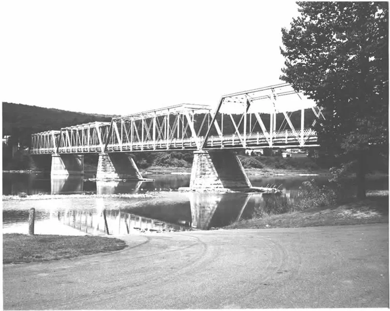
Spanning the Allegheny River between Hickory and Harmony Townships in Forest County, Pennsylvania, the West Hickory Bridge is a multiple-span Pratt through-truss highway bridge. Its five spans measure about 695.5 feet overall, and the main span is 139 feet. A bridge plate records that it was fabricated in 1896 by the Groton Bridge Company for the Hickory Bridge Company. The steel superstructure carries diamond railings, and the piers are stone, partly overlaid with concrete. The bridge is one of the longer Pratt through-truss bridges in its thematic group, and only a few bridges in that group were built by the Groton firm. Its importance rests on its engineering design and construction. In 1942 a trestle section was removed and replaced with earth fill. The bridge remains in vehicular use.
Significance in brief: The nomination describes the bridge as a typical example of a multiple-span Pratt truss and one of the longest Pratt through-truss bridges in the nominated group. A bridge plate records fabrication in 1896 by the Groton Bridge Company for Hickory Bridge Company, and the nomination notes that few bridges in the group were built by that prominent firm. Significance is marked under engineering.
Machine-generated summary. This summary was generated by a language model from the official nomination document and has not been reviewed line by line by an editor. It may contain errors. Check the source document before relying on any detail. Source: nomination document (PDF) · National Archives catalog entry. NRHP reference 88000835, listed June 22, 1988. Summary generated October 2026 (model claude-haiku-5-5, prompt v1.1-2026-10-29, confidence medium).
Key facts
| Address | LR 598 over Allegheny River, West Hickory |
|---|---|
| County | Forest County |
| Listed | June 22, 1988 |
| Reference number | 88000835 |
| Resource type | Structure |
| Period of significance | 1896 |
| Architect / builder | Groton Bridge Company for Hickory Bridge Co. (builder/contractor) |
| Criteria |
|
| Areas of significance | Engineering |
| Level of significance | State |
| Status (as stated in the nomination) | A 1942 alteration removed a trestle portion of the bridge and replaced it with fill; the bridge is in vehicular use. |
| Acreage | 0.9 |
| Coordinates | 41.56988, -79.40556 (NPS GIS) |
What listing means for this property
For a publicly owned building or structure, listing mainly matters when federal funds, permits or licences are involved: projects then go through Section 106 review so effects on the property are considered. Listing also strengthens applications for preservation grants and, for leased income-producing uses, can enable the federal rehabilitation tax credit.
General information, not legal or tax advice. Rules change; confirm with your State Historic Preservation Office or a qualified adviser.
Sources and further reading
- National Park Service, National Register of Historic Places database (snapshot May 2026), reference 88000835.
- Nomination form (PDF, National Archives) — catalog entry
- Wikipedia article (used for cross-checking only; text not reproduced here)
- Wikidata Q7985354
- This listing as JSON
Last updated October 2026. Found an error? See the editorial policy for how to report it.