Erie Land Lighthouse
Also known as: Presque Isle Lighthouse

Why it's listed
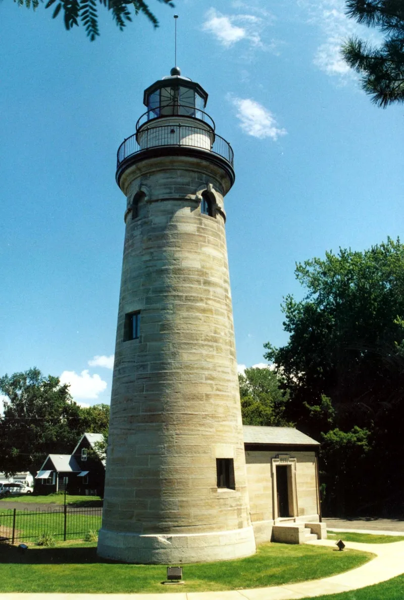
Built in 1867 on the mainland east of Erie's Public Docks, the Erie Land Lighthouse is the third lighthouse to occupy the site. The two earlier structures sank because of unstable ground, so the present tower was set on a foundation about twenty feet deep, with oak timbers, broken limestone and cement beneath eight-foot courses of stone. The tower is built of Berea sandstone and lined with brick, tapering from roughly 19 feet at the base to 14 feet at the top. It originally carried a fixed white light visible for 17 nautical miles, housed in a lantern with a lens made by L. Sauter and Son of Paris. Cast iron stairs of sixty-nine steps rise through the tower to two platforms. The lighthouse was among the first the federal government built on the Great Lakes. It is valued as a rare survivor in a state with almost no coastline, and it is being studied for restoration and educational use within Lighthouse Park.
Significance in brief: The nomination argues the lighthouse was the first built by the federal government on the Great Lakes and played an important role in early Great Lakes shipping. It notes that Pennsylvania is almost entirely landlocked, which it says makes this lighthouse a rare structure and a valuable historical and educational resource.
Machine-generated summary. This summary was generated by a language model from the official nomination document and has not been reviewed line by line by an editor. It may contain errors. Check the source document before relying on any detail. Source: nomination document (PDF) · National Archives catalog entry. NRHP reference 78002397, listed March 30, 1978. Summary generated October 2026 (model claude-haiku-5-5, prompt v1.1-2026-10-29, confidence medium).
Key facts
| Address | Dunn Blvd., Lighthouse Park, Erie |
|---|---|
| County | Erie County |
| Listed | March 30, 1978 |
| Reference number | 78002397 |
| Resource type | Building |
| Period of significance | 1867 |
| Architect / builder | United States Government |
| Areas of significance | Transportation, Architecture |
| Level of significance | National |
| Status (as stated in the nomination) | The building and tower are described as in good condition; the cupola has been removed and replaced with a temporary tar paper roof. |
| Acreage | 0.2 |
| Coordinates | 42.14374, -80.06287 (NPS GIS) |
What listing means for this property
For a publicly owned building or structure, listing mainly matters when federal funds, permits or licences are involved: projects then go through Section 106 review so effects on the property are considered. Listing also strengthens applications for preservation grants and, for leased income-producing uses, can enable the federal rehabilitation tax credit.
General information, not legal or tax advice. Rules change; confirm with your State Historic Preservation Office or a qualified adviser.
Sources and further reading
- National Park Service, National Register of Historic Places database (snapshot May 2026), reference 78002397.
- Nomination form (PDF, National Archives) — catalog entry
- Wikipedia article (used for cross-checking only; text not reproduced here)
- Wikidata Q1353751
- This listing as JSON
Last updated October 2026. Found an error? See the editorial policy for how to report it.