Legislative Route 1 Sycamore Allee

Why it's listed
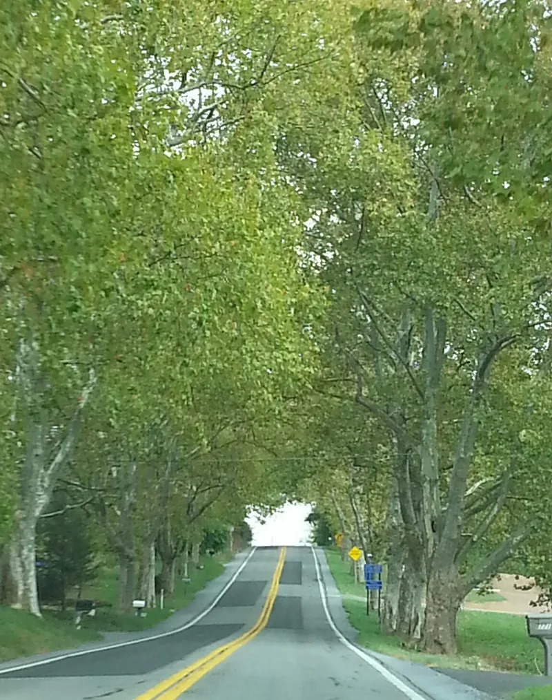
Oriental Plane trees line State Route 147 in Halifax and Reed Townships, Dauphin County, Pennsylvania, in two separated stretches totaling 314 trees as of 2006. The Highway Department and the Department of Forests and Waters planted the allee in 1922 as part of a state program to beautify important highways, and the trees were set about 60 feet apart on both sides of the road where practicable. The road follows part of the Shamokin Path, an early route between Harrisburg and Sunbury, and was designated Legislative Route 1 under the 1911 Sproul Highway Act. The planting is regarded as an example of landscape design applied to a rural road in the early twentieth century. Since planting, about a third of the southern trees and more than half of the northern trees have been lost, though the surviving trees remain in their original positions and the allee still conveys its historic design and character.
Significance in brief: The allee was planted in 1922 as part of a state program of roadside tree planting carried out by the Highway Department with the Department of Forests and Waters. The nomination argues it is a designed rural landscape that illustrates early twentieth-century landscape architecture and the state's beautification of rural roads. It retains enough integrity of location, design and association to convey that significance despite tree losses.
Machine-generated summary. This summary was generated by a language model from the official nomination document and has not been reviewed line by line by an editor. It may contain errors. Check the source document before relying on any detail. Source: nomination document (PDF) · National Archives catalog entry. NRHP reference 07000029, listed February 7, 2007. Summary generated October 2026 (model claude-haiku-5-5, prompt v1.1-2026-10-29, confidence high).
Key facts
| Address | Legislative Route 1, approx. 1 mil N and S of Halifax, Halifax and Reed |
|---|---|
| County | Dauphin County |
| Listed | February 7, 2007 |
| Reference number | 07000029 |
| Resource type | Site |
| Period of significance | 1922 |
| Criteria |
|
| Areas of significance | Landscape Architecture |
| Level of significance | Local |
| Status (as stated in the nomination) | Of the trees originally planted, about 143 in the southern section and about 89 in the northern section have been lost, and the trees that remain are still in place. |
| Acreage | 33.2 |
| Coordinates | 40.43609, -76.94935 (NPS GIS) |
What listing means for this property
Sites (archaeological sites, battlefields, landscapes) are often listed with a restricted address to protect them from looting or disturbance. Listing is honorary for private owners; federal undertakings on or near the site go through Section 106 review, and state laws may protect burials and artefacts regardless of listing.
General information, not legal or tax advice. Rules change; confirm with your State Historic Preservation Office or a qualified adviser.
Sources and further reading
- National Park Service, National Register of Historic Places database (snapshot May 2026), reference 07000029.
- Nomination form (PDF, National Archives) — catalog entry
- Wikipedia article (used for cross-checking only; text not reproduced here)
- Wikidata Q6518262
- This listing as JSON
Last updated October 2026. Found an error? See the editorial policy for how to report it.