Speakman No. 1

Why it's listed
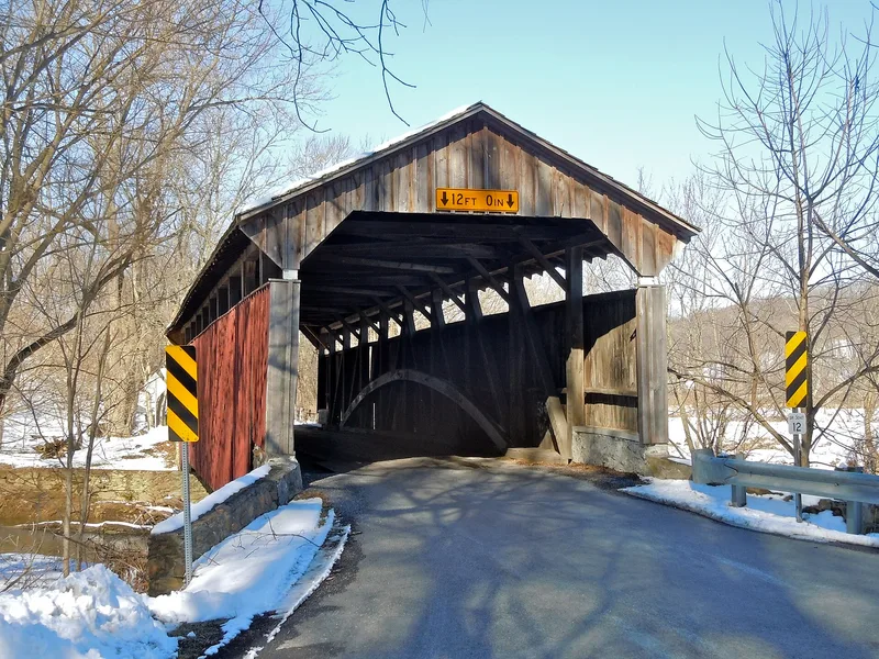
Built in 1881 over Buck Run in East Fallowfield Township, Chester County, this burr arch covered bridge is 75 feet long and 14 feet wide. Its builders were Meanander and Ferdinand Wood. The bridge stands in a remote valley and originally carried traffic serving the Jonathan Speakman grist mill, a building that had been converted from a papermill to a grist mill in 1870. The total construction cost was recorded as $2,000. It lies about 1.5 miles from the Speakman No. 2 bridge, another covered span in the same group. The county owns the structure, and its condition was recorded as good. Its inclusion rests on its role as a representative example of covered bridge construction in Chester County from the mid-to-late nineteenth century, a building type that the county group illustrates through several surviving examples of the burr arch and related truss forms.
Significance in brief: The document describes the bridge as one of eight covered bridge listings in the county group, all regarded as good examples of mid-to-late 19th-century covered bridge construction. It originally served the Jonathan Speakman grist mill, which had been converted from a papermill in 1870.
Machine-generated summary. This summary was generated by a language model from the official nomination document and has not been reviewed line by line by an editor. It may contain errors. Check the source document before relying on any detail. Source: nomination document (PDF) · National Archives catalog entry. NRHP reference 80003464, listed December 10, 1980. Summary generated October 2026 (model claude-haiku-5-5, prompt v1.1-2026-10-29, confidence low).
Key facts
| Address | S of Coatesville on LR 15068, East Fallowfield Township, Modena |
|---|---|
| County | Chester County |
| Listed | December 10, 1980 |
| Reference number | 80003464 |
| Resource type | Structure |
| Architect / builder | Meanander and Ferdinand Wood (builders) |
| Architectural style | Burr arch truss |
| Areas of significance | Engineering, Transportation |
| Level of significance | State |
| Status (as stated in the nomination) | Condition recorded as good. |
| Acreage | 0.9 |
| Coordinates | 39.92946, -75.82260 (NPS GIS) |
What listing means for this property
National Register listing is honorary: it recognises significance and does not restrict what a private owner may do without federal money or permits. It unlocks the 20% federal rehabilitation tax credit for income-producing buildings, state credits in many states, and Section 106 review when federal agencies are involved. See what listing means in practice.
General information, not legal or tax advice. Rules change; confirm with your State Historic Preservation Office or a qualified adviser.
Sources and further reading
- National Park Service, National Register of Historic Places database (snapshot May 2026), reference 80003464.
- Nomination form (PDF, National Archives) — catalog entry
- Wikipedia article (used for cross-checking only; text not reproduced here)
- Wikidata Q7574355
- This listing as JSON
Last updated October 2026. Found an error? See the editorial policy for how to report it.