Schuylkill Navigation Canal, Oakes Reach Section

Why it's listed
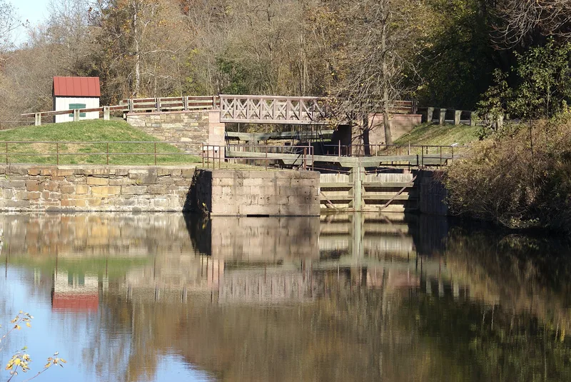
Watered canal section running about 5.1 miles between the Route 113 bridge near Black Rock Dam and Lock #61 on the Schuylkill River, with locks, a dam, lockhouses and a dry-dock site. Construction of the Schuylkill Navigation system began in 1816, and this section operated from 1824 to 1887 as part of a network that carried anthracite coal and merchandise to Philadelphia. The canal was widened to 60 feet in 1846, and Lock #60 dates to 1838-39, with its lockhouse dated 1839. Black Rock Dam, built in 1840, impounds a pool of about 95 acres. The section is considered significant for its role in moving raw materials and finished goods, and for supporting the growth of the Phoenix Iron Company and nearby villages such as Port Providence and Mont Clare. It is one of only two sections of the Schuylkill Canal still maintained with a controlled flow of river water, making it a rare surviving example of the system.
Significance in brief: The nomination argues the section was part of a transportation system that moved coal and merchandise and helped drive the growth of industry and villages in the Lower Schuylkill Valley, most notably the Phoenix Iron Company in Phoenixville. It is described as one of only two watered sections of the canal still remaining, with the other at Manayunk, and as one of the best preserved, since it still holds a controlled flow of river water.
Machine-generated summary. This summary was generated by a language model from the official nomination document and has not been reviewed line by line by an editor. It may contain errors. Check the source document before relying on any detail. Source: nomination document (PDF) · National Archives catalog entry. NRHP reference 88000462, listed May 6, 1988. Summary generated October 2026 (model claude-haiku-5-5, prompt v1.1-2026-10-29, confidence medium).
Key facts
| Address | N and E bank of Schuylkill River from PA 113 to Lock 61, Phoenixville |
|---|---|
| County | Chester County |
| Listed | May 6, 1988 |
| Reference number | 88000462 |
| Resource type | District |
| Period of significance | 1824-1887 |
| Criteria |
|
| Areas of significance | Transportation |
| Level of significance | State |
| Status (as stated in the nomination) | The canal is extant and watered from Black Rock Dam to just east of Longford Road; the section south to Lock #61 is in bad repair and partly buried. |
| Acreage | 155.3 |
| Coordinates | 40.14209, -75.43527 (NPS GIS) |
What listing means for this property
This is a historic district. Buildings within its boundary are either contributing (they add to the district's significance) or non-contributing. Owners of contributing income-producing buildings can claim the 20% federal rehabilitation tax credit; homeowners should look at state credits. National Register districts impose no design review by themselves; a local historic district ordinance, if one exists, does (the difference explained).
General information, not legal or tax advice. Rules change; confirm with your State Historic Preservation Office or a qualified adviser.
Sources and further reading
- National Park Service, National Register of Historic Places database (snapshot May 2026), reference 88000462.
- Nomination form (PDF, National Archives) — catalog entry
- Wikipedia article (used for cross-checking only; text not reproduced here)
- Wikidata Q7433092
- This listing as JSON
Last updated October 2026. Found an error? See the editorial policy for how to report it.