Berwind-White Mine 40 Historic District
Also known as: Eureka Mine No. 40; Mine 40

Why it's listed
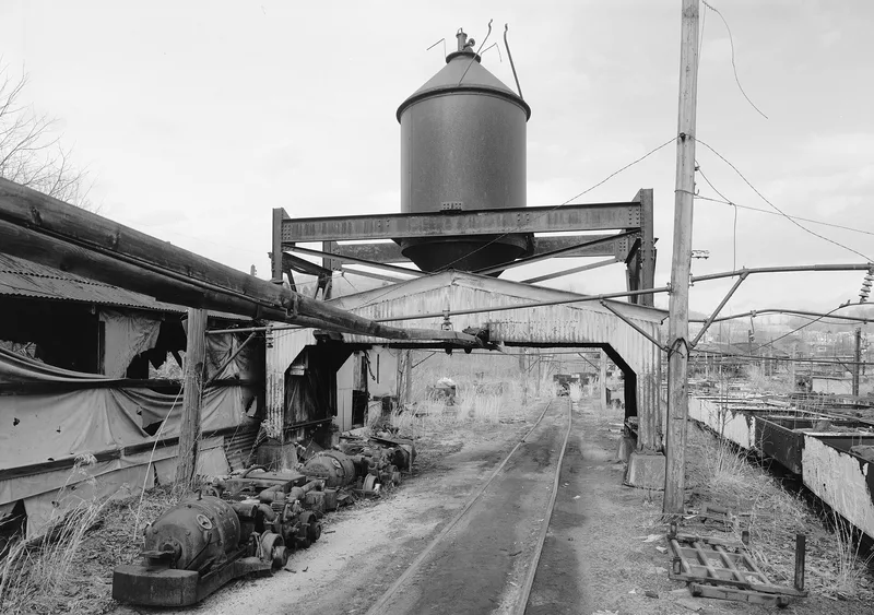
Begun in 1905 on farmland in southern Cambria County, the Eureka No. 40 mine and its surrounding patch town were built by the Berwind-White Coal Mining Company, with the houses constructed through its subsidiary, the Windber Lumber Company. The mine site sits on the creekside flats of Little Paint Creek, with a brick powerhouse completed in 1906 and a coal cleaning plant rebuilt in 1928 and expanded in 1941. The mine was among the company's most productive, reaching a peak of 767,921 tons in 1913, and its ventilation and power systems were regarded as advanced for their time. Patch houses were built in rows of identical double dwellings on a grid of streets up the hillside, typical of company towns across western Pennsylvania. The district is significant for its industrial technology and for its community planning, and it retains many of its mine buildings and worker houses, though some have lost original siding and windows.
Significance in brief: The district is significant for industry and community planning and development. Eureka No. 40 was one of Berwind-White's most productive mines and its mine technology served as a regional model. The associated patch community reflects common features of Pennsylvania coal towns, with cheaply built, similar houses and a clear hierarchy separating management from labor.
Machine-generated summary. This summary was generated by a language model from the official nomination document and has not been reviewed line by line by an editor. It may contain errors. Check the source document before relying on any detail. Source: nomination document (PDF) · National Archives catalog entry. NRHP reference 92000392, listed April 28, 1992. Summary generated October 2026 (model claude-haiku-5-5, prompt v1.1-2026-10-29, confidence high).
Key facts
| Address | Roughly bounded by the boney pile, Eureka No. 40 mine site, Scalp Level Borough line and Berwind--White Farmstead, Scalp Level |
|---|---|
| County | Cambria County |
| Listed | April 28, 1992 |
| Reference number | 92000392 |
| Resource type | District |
| Period of significance | 1905-1942 |
| Architect / builder | Windber Lumber Company |
| Criteria |
|
| Areas of significance | Industry, Community Planning and Development |
| Level of significance | State |
| Status (as stated in the nomination) | The mine closed in 1980 and the site has been vacant since, except for a small steel fabricating business in the former power house building. |
| Acreage | 194 |
| Coordinates | 40.25420, -78.83899 (NPS GIS) |
What listing means for this property
This is a historic district. Buildings within its boundary are either contributing (they add to the district's significance) or non-contributing. Owners of contributing income-producing buildings can claim the 20% federal rehabilitation tax credit; homeowners should look at state credits. National Register districts impose no design review by themselves; a local historic district ordinance, if one exists, does (the difference explained).
General information, not legal or tax advice. Rules change; confirm with your State Historic Preservation Office or a qualified adviser.
Sources and further reading
- National Park Service, National Register of Historic Places database (snapshot May 2026), reference 92000392.
- Nomination form (PDF, National Archives) — catalog entry
- Wikipedia article (used for cross-checking only; text not reproduced here)
- Wikidata Q4896030
- This listing as JSON
Last updated October 2026. Found an error? See the editorial policy for how to report it.