Quakertown Historic District

Why it's listed
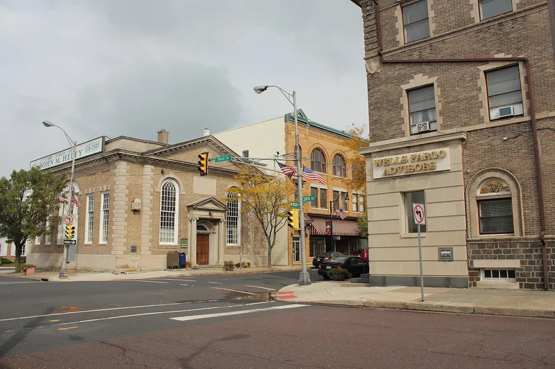
Quakertown's historic district covers most of the incorporated borough in upper Bucks County, Pennsylvania, and holds 2,401 resources, most of them houses built of stone and brick between the 1730s and the 1950s. Settlement began with Welsh Quakers by the 1720s, and the Lester family established a tannery around 1734 on West Broad Street. The town sat on the main road from Philadelphia to Bethlehem, and the Red Lion Hotel at Main and Broad served travelers. During the Revolution, the Liberty Bell was hidden behind Liberty Hall on September 23, 1777, on its way out of Philadelphia. The arrival of the railroad in 1856 and the trolley in 1898 drove growth, producing rows of brick houses and factories, including a stove foundry and a cigar factory. The district is listed for its architecture, its transportation and civic history, and its planned town layout.
Significance in brief: The district is argued to be significant for its transportation, political and community planning history, including its role as a regional stop on the Philadelphia to Bethlehem route, the railroad and trolley era, and the Fries Rebellion. It is also significant architecturally for its large, solid Georgian, Federal and later Victorian and Revival-style houses, double and row houses, and three-story factories.
Machine-generated summary. This summary was generated by a language model from the official nomination document and has not been reviewed line by line by an editor. It may contain errors. Check the source document before relying on any detail. Source: nomination document (PDF) · National Archives catalog entry. NRHP reference 11000200, listed April 20, 2011. Summary generated October 2026 (model claude-haiku-5-5, prompt v1.1-2026-10-29, confidence medium).
Key facts
| Address | Roughly bounded by Main and Broad Sts, Hellertown, Tichikon, and Park Aves, Quakertown |
|---|---|
| County | Bucks County |
| Listed | April 20, 2011 |
| Reference number | 11000200 |
| Resource type | District |
| Period of significance | 1734-1957 |
| Architectural style | Colonial; Georgian; Federal; Italianate; Second Empire; Gothic Revival; Queen Anne; Romanesque; Prairie; Classical Revival; Craftsman; Colonial Revival; Art Deco |
| Criteria |
|
| Areas of significance | Architecture, Politics/Government, Community Planning and Development, Transportation, Exploration/Settlement |
| Level of significance | Local |
| Acreage | 386 |
| Coordinates | 40.44420, -75.34057 (NPS GIS) |
What listing means for this property
This is a historic district. Buildings within its boundary are either contributing (they add to the district's significance) or non-contributing. Owners of contributing income-producing buildings can claim the 20% federal rehabilitation tax credit; homeowners should look at state credits. National Register districts impose no design review by themselves; a local historic district ordinance, if one exists, does (the difference explained).
General information, not legal or tax advice. Rules change; confirm with your State Historic Preservation Office or a qualified adviser.
Sources and further reading
- National Park Service, National Register of Historic Places database (snapshot May 2026), reference 11000200.
- Nomination form (PDF, National Archives) — catalog entry
- Wikipedia article (used for cross-checking only; text not reproduced here)
- Wikidata Q7268604
- This listing as JSON
Last updated October 2026. Found an error? See the editorial policy for how to report it.