Fischtner Covered Bridge

Why it's listed
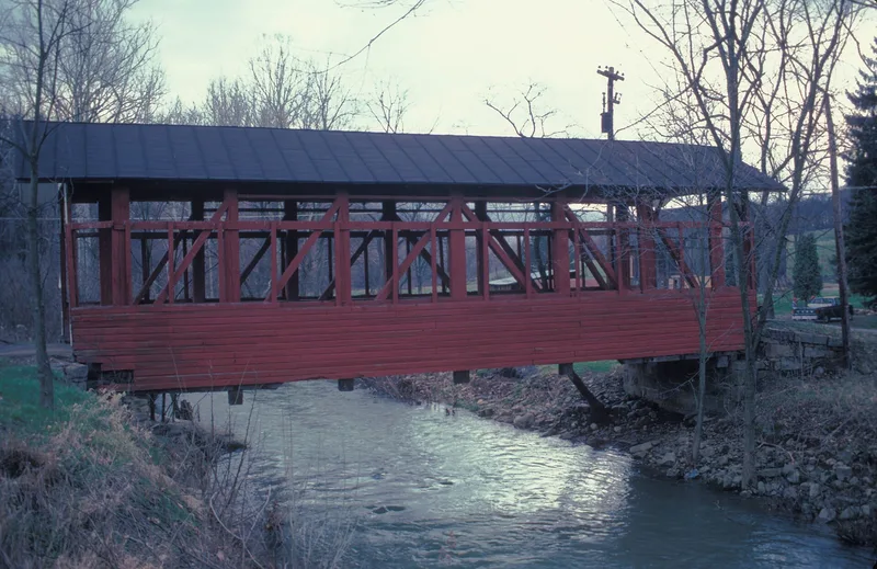
Fischtner Covered Bridge is a wood covered bridge built in 1880 over Gladdens Run in Londonderry Township, Bedford County, Pennsylvania. It stands on private land off L.R. 05007 near Stringtown. The bridge has a multiple post truss, a form that is unusual for Bedford County. Its end posts are 56 feet long, the roadbed is about 13 feet wide, and the clearance is 12 feet. The structure is in good condition and continues to carry traffic to private land. It was nominated as part of a group of county covered bridges. Covered bridges of this kind were once common in Bedford County, and the survey counted fourteen surviving examples. Fischtner is valued as an example of nineteenth-century wood bridge building, showing how timber trusses were designed and assembled to carry local roads across streams.
Significance in brief: The nomination argues the bridge is eligible as an example of a type of transportation architecture, embodying 19th-century wood bridge technology once common in Bedford County. It notes the bridge has an unusual truss type for the county. The county survey counted 14 extant covered bridges, with one more altered.
Machine-generated summary. This summary was generated by a language model from the official nomination document and has not been reviewed line by line by an editor. It may contain errors. Check the source document before relying on any detail. Source: nomination document (PDF) · National Archives catalog entry. NRHP reference 80003422, listed April 10, 1980. Summary generated October 2026 (model claude-haiku-5-5, prompt v1.1-2026-10-29, confidence medium).
Key facts
| Address | N of Stringtown off LR 05007, Londonderry Township, Stringtown |
|---|---|
| County | Bedford County |
| Listed | April 10, 1980 |
| Reference number | 80003422 |
| Resource type | Structure |
| Criteria |
|
| Areas of significance | Engineering, Transportation, Architecture |
| Level of significance | Local |
| Status (as stated in the nomination) | Condition recorded as good; currently used for access to private land. |
| Acreage | 0.9 |
| Coordinates | 39.76361, -78.75131 (NPS GIS) |
What listing means for this property
For a publicly owned building or structure, listing mainly matters when federal funds, permits or licences are involved: projects then go through Section 106 review so effects on the property are considered. Listing also strengthens applications for preservation grants and, for leased income-producing uses, can enable the federal rehabilitation tax credit.
General information, not legal or tax advice. Rules change; confirm with your State Historic Preservation Office or a qualified adviser.
Sources and further reading
- National Park Service, National Register of Historic Places database (snapshot May 2026), reference 80003422.
- Nomination form (PDF, National Archives) — catalog entry
- Wikipedia article (used for cross-checking only; text not reproduced here)
- Wikidata Q5454449
- This listing as JSON
Last updated October 2026. Found an error? See the editorial policy for how to report it.