Cuppett's Covered Bridge
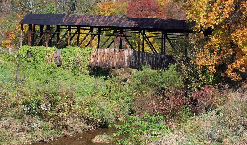

Why it's listed
No readable nomination text is available for this listing yet. The facts below come from the National Park Service database.
Key facts
| Address | 1 mi. N of New Paris, Napier Township, New Paris |
|---|---|
| County | Bedford County |
| Listed | April 10, 1980 |
| Reference number | 80003423 |
| Resource type | Structure |
| Areas of significance | Engineering, Transportation, Architecture |
| Level of significance | Local |
| Acreage | 0.9 |
| Coordinates | 40.12839, -78.63899 (NPS GIS) |
What listing means for this property
For a publicly owned building or structure, listing mainly matters when federal funds, permits or licences are involved: projects then go through Section 106 review so effects on the property are considered. Listing also strengthens applications for preservation grants and, for leased income-producing uses, can enable the federal rehabilitation tax credit.
General information, not legal or tax advice. Rules change; confirm with your State Historic Preservation Office or a qualified adviser.
Sources and further reading
- National Park Service, National Register of Historic Places database (snapshot May 2026), reference 80003423.
- Wikipedia article (used for cross-checking only; text not reproduced here)
- Wikidata Q12063877
- This listing as JSON
Last updated October 2026. Found an error? See the editorial policy for how to report it.