Hope Furnace

Why it's listed
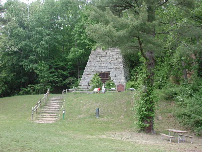
Hope Furnace is the surviving stack of a charcoal iron furnace a few hundred feet from Ohio Route 278, about five miles northeast of Zaleski in Vinton County. It produced iron from 1854 to 1874 and is one of only two remaining furnace ruins in the county. The stack is built of sandstone, rectangular in plan and tapering upward, with a lining of clay-bonded sandstone or fire brick. It stood 35 feet tall, and in 1870 it produced 2,827 tons of foundry iron. A community of several hundred people once surrounded the furnace, with workers paid in scrip redeemable at the company store. When operations ended, the village and its buildings disappeared. The furnace is part of the Hanging Rock Iron Region, which ranked among the nation's main iron-producing areas during the Civil War era and spurred road and railroad development. The site is now state-owned, near the Lake Hope recreation area.
Significance in brief: It is one of two surviving charcoal iron furnaces in Vinton County and represents the Hanging Rock Iron Region, a major iron-producing area during the Civil War era. The iron industry shaped the region's roads, railroads and settlement, and villages like Hope vanished when the furnaces closed.
Machine-generated summary. This summary was generated by a language model from the official nomination document and has not been reviewed line by line by an editor. It may contain errors. Check the source document before relying on any detail. Source: nomination document (PDF) · National Archives catalog entry. NRHP reference 73001546, listed May 25, 1973. Summary generated October 2026 (model claude-sonnet-5-5, prompt v1.0-2026-10-29, confidence medium).
Key facts
| Address | 5 mi. NE of Zaleski on OH 278, Zaleski |
|---|---|
| County | Vinton County |
| Listed | May 25, 1973 |
| Reference number | 73001546 |
| Resource type | Structure |
| Period of significance | 19th Century; specific date 1854 |
| Areas of significance | Industry |
| Level of significance | Local |
| Status (as stated in the nomination) | Described as a deteriorated, altered ruin; only the furnace stack remains. The site is state-owned, part of public land, and open to the public without restriction. |
| Acreage | 0.9 |
| Coordinates | 39.33200, -82.34018 (NPS GIS) |
What listing means for this property
National Register listing is honorary: it recognises significance and does not restrict what a private owner may do without federal money or permits. It unlocks the 20% federal rehabilitation tax credit for income-producing buildings, state credits in many states, and Section 106 review when federal agencies are involved. See what listing means in practice.
General information, not legal or tax advice. Rules change; confirm with your State Historic Preservation Office or a qualified adviser.
Sources and further reading
- National Park Service, National Register of Historic Places database (snapshot May 2026), reference 73001546.
- Nomination form (PDF, National Archives) — catalog entry
- Wikipedia article (used for cross-checking only; text not reproduced here)
- Wikidata Q5899258
- This listing as JSON
Last updated October 2026. Found an error? See the editorial policy for how to report it.