Seven Ranges Terminus

Why it's listed
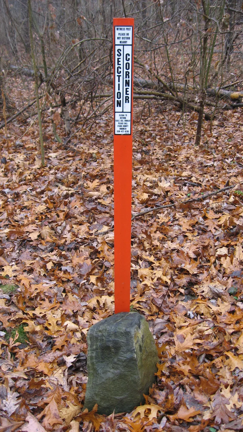
A small granite marker, roughly 12 inches high and 6 inches across, sits on a rolling, uncultivated hillside near Magnolia in Stark County, Ohio. Its top bears an incised surveyor's cross, and it lies exactly 42 miles due west of the starting point of the public land survey. The stone marks the end of the seventh range of townships and the meeting point of Stark, Carroll and Tuscarawas counties. It records the close of the first phase of the U.S. Public Land Survey, led by Thomas Hutchins, the nation's first Geographer. Hutchins developed the rectangular survey method, which the Land Ordinance of 1785 required for dividing western lands into townships six miles square. His work along the base line known as the Geographer's Line ended here in 1786. The survey proved the method accurate and practical, and it was later used to lay out millions of acres in many states.
Significance in brief: The marker shows where the first phase of the U.S. Public Land Survey ended under Thomas Hutchins, Geographer of the United States. The survey showed that the rectangular system, set out in the Land Ordinance of 1785, was accurate and workable. That system was then used to survey public lands across much of the country.
Machine-generated summary. This summary was generated by a language model from the official nomination document and has not been reviewed line by line by an editor. It may contain errors. Check the source document before relying on any detail. Source: nomination document (PDF) · National Archives catalog entry. NRHP reference 76001527, listed December 12, 1976. Summary generated October 2026 (model claude-sonnet-5-5, prompt v1.0-2026-10-29, confidence medium).
Key facts
| Address | W of Magnolia at jct. of Stark, Tuscarawas, and Carroll counties, Magnolia |
|---|---|
| County | Stark County |
| Listed | December 12, 1976 |
| Reference number | 76001527 |
| Resource type | Site |
| Period of significance | 1700-1799 (specific date 1786) |
| Architectural style | Not applicable |
| Areas of significance | Exploration/Settlement |
| Level of significance | National |
| Status (as stated in the nomination) | Condition listed as good, original site; located on an uncultivated rolling hillside; status marked unoccupied. |
| Acreage | 0.9 |
| Coordinates | 40.65193, -81.31801 (NPS GIS) |
What listing means for this property
Sites (archaeological sites, battlefields, landscapes) are often listed with a restricted address to protect them from looting or disturbance. Listing is honorary for private owners; federal undertakings on or near the site go through Section 106 review, and state laws may protect burials and artefacts regardless of listing.
General information, not legal or tax advice. Rules change; confirm with your State Historic Preservation Office or a qualified adviser.
Sources and further reading
- National Park Service, National Register of Historic Places database (snapshot May 2026), reference 76001527.
- Nomination form (PDF, National Archives) — catalog entry
- Wikipedia article (used for cross-checking only; text not reproduced here)
- Wikidata Q1625618
- This listing as JSON
Last updated October 2026. Found an error? See the editorial policy for how to report it.