Y Bridge

Why it's listed
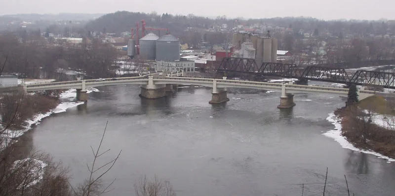
Y Bridge carries traffic from the foot of Main Street in Zanesville, Ohio, across the Muskingum River, then divides at a pier into two branches that cross the mouth of the Licking River. Built of steel and concrete, it has eight spans and nearly a thousand feet of length, with a 30-foot roadway width. A contract for it was let in September 1900, and it opened in January 1902. It is the fourth bridge at the site, following covered and partly covered predecessors from 1814, 1819 and 1832, some of which collapsed or were condemned. The nomination highlights its early use of concrete-steel construction, its unusually flat arch, and its status as the only Y bridge then in existence. It also describes the bridge as the purest example of its shape in the country. The original concrete balustrade was replaced with a pipe railing after damage in the 1913 flood, but the structure is otherwise essentially unchanged.
Significance in brief: It was one of the first bridges in the U.S. built with concrete-steel construction and was the only Y bridge in existence at the time. It is described as the best known and purest in shape and design of any such bridge in the country. It also continues a long local tradition of a Y bridge at this site dating to 1814.
Machine-generated summary. This summary was generated by a language model from the official nomination document and has not been reviewed line by line by an editor. It may contain errors. Check the source document before relying on any detail. Source: nomination document (PDF) · National Archives catalog entry. NRHP reference 73001516, listed November 2, 1973. Summary generated October 2026 (model claude-sonnet-5-5, prompt v1.0-2026-10-29, confidence medium).
Key facts
| Address | At foot of Main St., over the Licking and Muskingum rivers, Zanesville |
|---|---|
| County | Muskingum County |
| Listed | November 2, 1973 |
| Reference number | 73001516 |
| Resource type | Structure |
| Period of significance | 20th Century; specific date 1902 |
| Areas of significance | Engineering, Transportation |
| Level of significance | State |
| Status (as stated in the nomination) | Listed as in good condition and essentially unchanged apart from a replaced balustrade; a later agreement describes a planned replacement of the superstructure while retaining the substructure. The form marks it as occupied and in transportation use. |
| Acreage | 2 |
| Within district | Muskingum River Navigation Historic District |
| Coordinates | 39.94043, -82.01324 (NPS GIS) |
What listing means for this property
For a publicly owned building or structure, listing mainly matters when federal funds, permits or licences are involved: projects then go through Section 106 review so effects on the property are considered. Listing also strengthens applications for preservation grants and, for leased income-producing uses, can enable the federal rehabilitation tax credit.
General information, not legal or tax advice. Rules change; confirm with your State Historic Preservation Office or a qualified adviser.
Sources and further reading
- National Park Service, National Register of Historic Places database (snapshot May 2026), reference 73001516.
- Nomination form (PDF, National Archives) — catalog entry
- Wikipedia article (used for cross-checking only; text not reproduced here)
- Wikidata Q8045693
- This listing as JSON
Last updated October 2026. Found an error? See the editorial policy for how to report it.