"S" Bridge II

Why it's listed
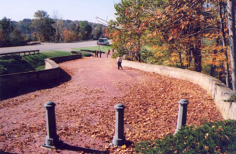
Just west of New Concord, Ohio, U.S. Route 40 crosses Fox Creek on an S-shaped stone bridge built in 1828 as part of the National Road. The structure is about 140 feet long and 26 feet wide, with a single 30-foot arch over the creek. The roadway curves slightly less than 20 degrees south at the east end and slightly less than 22 degrees north at the west end. Walls and vault are cut stone laid in courses, and the floor is brick. The S shape had practical purposes: it avoided sharp approach curves, shortened the arch needed, avoided steep grades and protected the back fill from erosion. Because the road meets the stream at an angle, a straight crossing would have cost more. The bridge is one of five original National Road S bridges remaining in eastern Ohio. In 1936 the Ohio chapter of the Daughters of the American Revolution persuaded the highway department to build around such bridges rather than replace them. It remains passable without load limits.
Significance in brief: It is one of five original National Road S bridges still standing in eastern Ohio and shows a functional design that avoided sharp approach curves, shortened the arch and reduced excavation. It has carried traffic for over a century, and the nomination cites engineering, commerce and transportation as areas of significance.
Machine-generated summary. This summary was generated by a language model from the official nomination document and has not been reviewed line by line by an editor. It may contain errors. Check the source document before relying on any detail. Source: nomination document (PDF) · National Archives catalog entry. NRHP reference 73001513, listed April 23, 1973. Summary generated October 2026 (model claude-sonnet-5-5, prompt v1.0-2026-10-29, confidence medium).
Key facts
| Address | U.S. 40 W of New Concord, New Concord |
|---|---|
| County | Muskingum County |
| Listed | April 23, 1973 |
| Reference number | 73001513 |
| Resource type | Structure |
| Period of significance | 1828 (19th Century) |
| Areas of significance | Commerce, Engineering, Transportation |
| Level of significance | State |
| Status (as stated in the nomination) | Listed in excellent condition; altered only by a brick floor and some repointing. It is passable today with no load limits, and a roadway was built around it in 1936 rather than replacing it. |
| Acreage | 1 |
| Within district | Muskingum River Navigation Historic District |
| Coordinates | 39.99301, -81.74647 (NPS GIS) |
What listing means for this property
For a publicly owned building or structure, listing mainly matters when federal funds, permits or licences are involved: projects then go through Section 106 review so effects on the property are considered. Listing also strengthens applications for preservation grants and, for leased income-producing uses, can enable the federal rehabilitation tax credit.
General information, not legal or tax advice. Rules change; confirm with your State Historic Preservation Office or a qualified adviser.
Sources and further reading
- National Park Service, National Register of Historic Places database (snapshot May 2026), reference 73001513.
- Nomination form (PDF, National Archives) — catalog entry
- Wikipedia article (used for cross-checking only; text not reproduced here)
- Wikidata Q2080070
- This listing as JSON
Last updated October 2026. Found an error? See the editorial policy for how to report it.