Knowlton Covered Bridge (Additional Documentation)
Also known as: Long Covered Bridge

Why it's listed
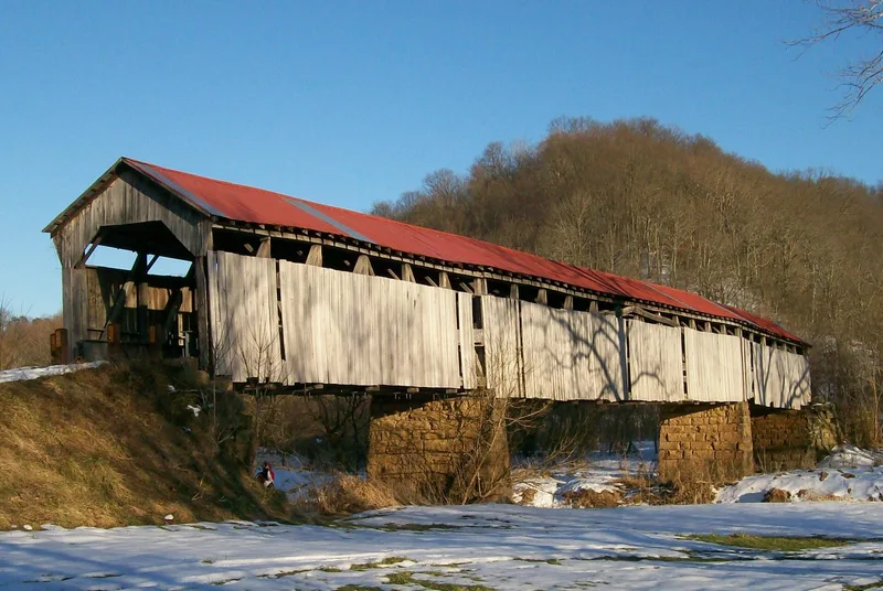
Spanning the Little Muskingum River near Rinards Mills in Monroe County, Ohio, this three-span wooden covered bridge combines a Burr arch truss in its central section with multiple king post trusses. It measures 192 feet long and 15 feet wide, with spans of 42, 44 and 42 feet resting on cut stone abutments and two piers. The deck is wood and the roof is covered with metal. Local sources place the original construction around 1860; a flood in the late 1880s washed it off its foundation, and it was rebuilt soon after in a similar configuration. In 1938 restorer Louis S. "Stock" Bower added steel rods, floor beams and stringers. The bridge is valued as one of Ohio's few well-preserved examples of the Burr arch, a design patented by Theodore Burr in 1817. It is also one of the state's two longest covered bridges and one of two left in the county.
Significance in brief: It is one of the few well-preserved Ohio covered bridges using the Burr arch truss, an early design invented by Theodore Burr. At 192 feet long it is one of the two longest covered bridges in Ohio, and it is one of only two surviving in Monroe County.
Machine-generated summary. This summary was generated by a language model from the official nomination document and has not been reviewed line by line by an editor. It may contain errors. Check the source document before relying on any detail. Source: nomination document (PDF) · National Archives catalog entry. NRHP reference 80003165, listed March 11, 1980. Summary generated October 2026 (model claude-sonnet-5-5, prompt v1.0-2026-10-29, confidence medium).
Key facts
| Address | N of Rinards Mills on SR 387-A, Rinards Mills |
|---|---|
| County | Monroe County |
| Listed | March 11, 1980 |
| Reference number | 80003165 |
| Resource type | Structure |
| Period of significance | 1800-1899 |
| Architectural style | Burr arch truss combined with multiple king post truss |
| Areas of significance | Transportation |
| Level of significance | State |
| Status (as stated in the nomination) | Condition listed as fair and unaltered on its original site; some side boards removed and the substructure somewhat deteriorated at the western end. Owned by the Monroe County Commissioners, with a two ton load limit. |
| Acreage | 0.9 |
| Coordinates | 39.60120, -81.15719 (NPS GIS) |
What listing means for this property
For a publicly owned building or structure, listing mainly matters when federal funds, permits or licences are involved: projects then go through Section 106 review so effects on the property are considered. Listing also strengthens applications for preservation grants and, for leased income-producing uses, can enable the federal rehabilitation tax credit.
General information, not legal or tax advice. Rules change; confirm with your State Historic Preservation Office or a qualified adviser.
Sources and further reading
- National Park Service, National Register of Historic Places database (snapshot May 2026), reference 80003165.
- Nomination form (PDF, National Archives) — catalog entry
- Wikipedia article (used for cross-checking only; text not reproduced here)
- Wikidata Q58904128
- This listing as JSON
Last updated October 2026. Found an error? See the editorial policy for how to report it.