Grand Lake St. Marys Lighthouse

Why it's listed
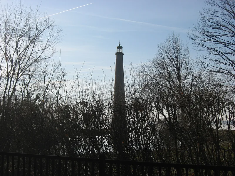
Rising from a wooded point on the north shore of Grand Lake St. Marys, this lighthouse sits in the Northwood Addition between Celina and St. Marys in western Ohio. Built in 1923, it copies the Eddystone Lighthouse off the coast of Cornwall, England. A circular base of cut stone about 10 feet high is ringed by a guardrail, and about forty feet of concrete shaft rises above it to a glass and bronze dome enclosing a beacon, topped with an ornamental weathervane. Its purpose is primarily decorative. The nomination values it as the only lighthouse in landlocked western Ohio and as an impressive structure on a lake once the largest man-made lake in the country. The lake had earlier served as a reservoir for the Miami-Erie Canal, and the lighthouse came after that era. The builder is unknown. The nominated area is under an acre, bounded by water on three sides.
Significance in brief: The nomination argues it is architecturally significant because it is the only lighthouse in landlocked western Ohio. It is primarily ornamental and stands on what was formerly the largest man-made lake in the country. It was built after the lake's use as a reservoir for the Miami-Erie Canal had ended.
Machine-generated summary. This summary was generated by a language model from the official nomination document and has not been reviewed line by line by an editor. It may contain errors. Check the source document before relying on any detail. Source: nomination document (PDF) · National Archives catalog entry. NRHP reference 82003614, listed June 2, 1982. Summary generated October 2026 (model claude-sonnet-5-5, prompt v1.0-2026-10-29, confidence medium).
Key facts
| Address | Grand Lake St. Marys-Northwood Addition, Celinda |
|---|---|
| County | Mercer County |
| Listed | June 2, 1982 |
| Reference number | 82003614 |
| Resource type | Structure |
| Period of significance | 1900- (specific date 1923) |
| Architect / builder | Unknown |
| Areas of significance | Landscape Architecture |
| Level of significance | Local |
| Status (as stated in the nomination) | Listed as private property, marked as unaltered and on its original site, with its present use given as decorative. |
| Acreage | 0.9 |
| Coordinates | 40.54354, -84.48134 (NPS GIS) |
What listing means for this property
For a publicly owned building or structure, listing mainly matters when federal funds, permits or licences are involved: projects then go through Section 106 review so effects on the property are considered. Listing also strengthens applications for preservation grants and, for leased income-producing uses, can enable the federal rehabilitation tax credit.
General information, not legal or tax advice. Rules change; confirm with your State Historic Preservation Office or a qualified adviser.
Sources and further reading
- National Park Service, National Register of Historic Places database (snapshot May 2026), reference 82003614.
- Nomination form (PDF, National Archives) — catalog entry
- Wikipedia article (used for cross-checking only; text not reproduced here)
- Wikidata Q5594736
- This listing as JSON
Last updated October 2026. Found an error? See the editorial policy for how to report it.