Buffington Island

Why it's listed
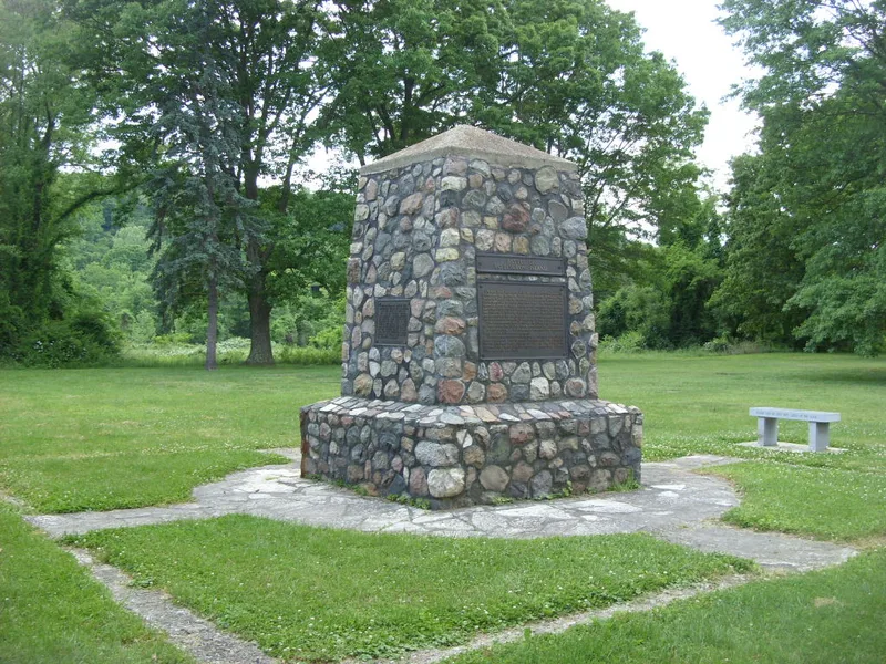
Buffington Island is a battle site on the Ohio shore in Lebanon Township, Meigs County, Ohio, opposite an island in the Ohio River. A fieldstone obelisk now marks the battlefield, which otherwise keeps essentially its original appearance. On July 19, 1863, Union forces under Brig. Gens. Henry M. Judah and Edward H. Hobson, supported by two gunboats, intercepted Confederate cavalry leader John Hunt Morgan as he tried to cross the river into West Virginia. About 120 of Morgan's men were killed and roughly 700 captured, and only a small group escaped across the river. Morgan fled up the Ohio side and surrendered on July 26 near West Point in Columbiana County. The nomination describes the site as the scene of the only significant Civil War battle fought in Ohio and the start of the defeat of Morgan's Raiders. It was given to the Ohio Historical Society in 1929 and is maintained as a state memorial and park of about four acres.
Significance in brief: The nomination calls it the scene of the only significant Civil War battle fought in Ohio. The fight marked the beginning of the defeat of Confederate General John Hunt Morgan's raiders, who were blocked from crossing the Ohio River into West Virginia. It is rated as locally significant in the military area.
Machine-generated summary. This summary was generated by a language model from the official nomination document and has not been reviewed line by line by an editor. It may contain errors. Check the source document before relying on any detail. Source: nomination document (PDF) · National Archives catalog entry. NRHP reference 70000508, listed November 10, 1970. Summary generated October 2026 (model claude-sonnet-5-5, prompt v1.0-2026-10-29, confidence medium).
Key facts
| Address | 20 mi. SE of Pomeroy on OH 124, Pomeroy |
|---|---|
| County | Meigs County |
| Listed | November 10, 1970 |
| Reference number | 70000508 |
| Resource type | Site |
| Period of significance | 1863 |
| Areas of significance | Military |
| Level of significance | State |
| Status (as stated in the nomination) | Condition is listed as good, unaltered and on its original site; the site retains essentially its original appearance apart from the monument. It is owned by the Ohio Historical Society and used as a park. |
| Acreage | 4 |
| Coordinates | 39.00247, -81.77476 (NPS GIS) |
What listing means for this property
Sites (archaeological sites, battlefields, landscapes) are often listed with a restricted address to protect them from looting or disturbance. Listing is honorary for private owners; federal undertakings on or near the site go through Section 106 review, and state laws may protect burials and artefacts regardless of listing.
General information, not legal or tax advice. Rules change; confirm with your State Historic Preservation Office or a qualified adviser.
Sources and further reading
- National Park Service, National Register of Historic Places database (snapshot May 2026), reference 70000508.
- Nomination form (PDF, National Archives) — catalog entry
- Wikidata Q34823977
- This listing as JSON
Last updated October 2026. Found an error? See the editorial policy for how to report it.