Toledo Harbor Light

Why it's listed
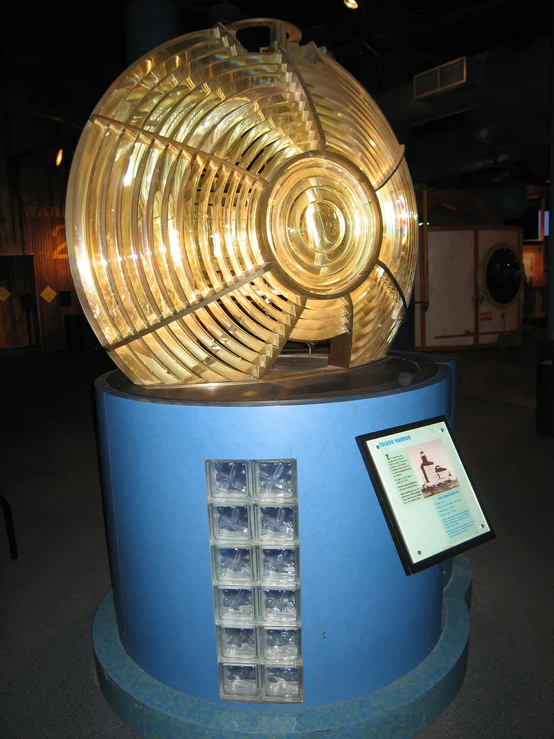
Toledo Harbor Light is an offshore lighthouse and fog signal station standing in 21 feet of water at the outer entrance to Maumee Bay, at the western end of Lake Erie. After the channel into the Maumee River was straightened in 1897, deep-draft vessels could reach Toledo more easily, and the added traffic called for a permanent light to mark the channel's outer end. Construction ran from 1901 to 1904, and the light first shone on 23 May 1904. A stone-filled crib supports a concrete base topped by a three-story, buff brick Romanesque building with a steel frame and cast-iron cornice. A one-story fog signal annex adjoins it, and a tower rises through the center to a cylindrical lantern. The original Paris-made third-order lens remains in use. Automated in 1965, the light has a nominal range of 24 miles. It is recorded as having played an important part in Toledo's growth as a port.
Significance in brief: The light marked the outer end of the straight channel into the Maumee River, improved in 1897, where growing deep-draft ship traffic urgently required a permanent light and fog signal. The record says it played an important role in Toledo's development as a port. It also retains its original Paris-made lens and Romanesque-style buff brick building.
Machine-generated summary. This summary was generated by a language model from the official nomination document and has not been reviewed line by line by an editor. It may contain errors. Check the source document before relying on any detail. Source: nomination document (PDF) · National Archives catalog entry. NRHP reference 83002005, listed August 4, 1983. Summary generated October 2026 (model claude-sonnet-5-5, prompt v1.0-2026-10-29, confidence medium).
Key facts
| Address | Toledo Harbor, Toledo |
|---|---|
| County | Lucas County |
| Listed | August 4, 1983 |
| Reference number | 83002005 |
| Resource type | Structure |
| Period of significance | 1901-1904 |
| Architectural style | Romanesque |
| Areas of significance | Commerce, Engineering, Transportation |
| Level of significance | State |
| Status (as stated in the nomination) | Condition listed as good; still in use as a harbor light and fog signal, automated in 1965 and running on commercial power. |
| Acreage | 0.3 |
| Coordinates | 41.71798, -83.42145 (NPS GIS) |
What listing means for this property
National Register listing is honorary: it recognises significance and does not restrict what a private owner may do without federal money or permits. It unlocks the 20% federal rehabilitation tax credit for income-producing buildings, state credits in many states, and Section 106 review when federal agencies are involved. See what listing means in practice.
General information, not legal or tax advice. Rules change; confirm with your State Historic Preservation Office or a qualified adviser.
Sources and further reading
- National Park Service, National Register of Historic Places database (snapshot May 2026), reference 83002005.
- Nomination form (PDF, National Archives) — catalog entry
- Wikipedia article (used for cross-checking only; text not reproduced here)
- Wikidata Q14716827
- This listing as JSON
Last updated October 2026. Found an error? See the editorial policy for how to report it.