Flint Ridge State Memorial

Why it's listed
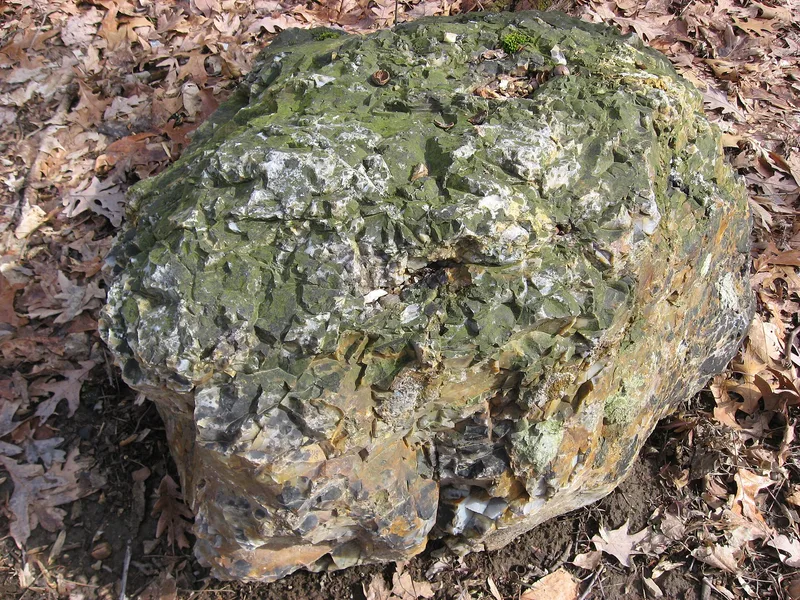
Flint Ridge State Memorial is a forested, hilly tract in Licking County, Ohio, where prehistoric people quarried flint for thousands of years. The nominated 250 acres hold the heaviest concentration of quarries, with pits 2 to 20 feet deep and 10 to 60 feet across, bordered by piles of chips. The flint comes in red, green, blue, yellow, white, grey and black, and can be flaked into tools. Paleo-Indians found the outcrops about 8,000 to 10,000 years ago, and trails from across the Midwest led to the ridge. Workers drove wooden or bone wedges into cracks in the flint layer with heavy hammerstones, then carried the material off for tool making. Flint Ridge material has turned up on the Atlantic coast, in Louisiana and as far west as Kansas City. The Ohio Historical Society established the memorial in 1933, and a museum was built over an original pit in 1968. The flint became Ohio's official gemstone in 1965.
Significance in brief: The ridge was a major source of colorful, high-quality flint that prehistoric Indians quarried for thousands of years. Flint from the site has been found from the Atlantic seaboard to Louisiana and Kansas City. The nominated area is dotted with ancient quarry pits and chip piles.
Machine-generated summary. This summary was generated by a language model from the official nomination document and has not been reviewed line by line by an editor. It may contain errors. Check the source document before relying on any detail. Source: nomination document (PDF) · National Archives catalog entry. NRHP reference 70000505, listed November 10, 1970. Summary generated October 2026 (model claude-sonnet-5-5, prompt v1.0-2026-10-29, confidence high).
Key facts
| Address | 2 mi. N of Brownsville, Brownsville |
|---|---|
| County | Licking County |
| Listed | November 10, 1970 |
| Reference number | 70000505 |
| Resource type | Site |
| Period of significance | Pre-Columbian; 10,000 B.C. ff. |
| Areas of significance | Prehistoric |
| Level of significance | State |
| Status (as stated in the nomination) | Condition listed as excellent and unaltered, on its original site. It is used as a park and has a museum built in 1968 over one of the original flint pits. |
| Acreage | 250 |
| Coordinates | 39.98962, -82.26928 (NPS GIS) |
What listing means for this property
Sites (archaeological sites, battlefields, landscapes) are often listed with a restricted address to protect them from looting or disturbance. Listing is honorary for private owners; federal undertakings on or near the site go through Section 106 review, and state laws may protect burials and artefacts regardless of listing.
General information, not legal or tax advice. Rules change; confirm with your State Historic Preservation Office or a qualified adviser.
Sources and further reading
- National Park Service, National Register of Historic Places database (snapshot May 2026), reference 70000505.
- Nomination form (PDF, National Archives) — catalog entry
- Wikipedia article (used for cross-checking only; text not reproduced here)
- Wikidata Q5459552
- This listing as JSON
Last updated October 2026. Found an error? See the editorial policy for how to report it.