Mount Pleasant Historic District
Also known as: See Also:Friends Meetinghouse; Lundy,Benjamin,House

Why it's listed
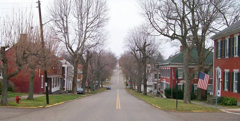
Mount Pleasant, in Jefferson County, Ohio, was laid out in 1803 by Jesse Thomas and Robert Carothers, and its core is preserved as a historic district of about 54 acres. Until the 1880s it was the industrial center of the township, and many substantial brick houses and commercial buildings from that period remain, especially around Union Street. Examples include the Benjamin Lundy House, the Samuel Jones row houses, the John Hogg House and Union Hall, built in 1854. The village also drew Quaker settlers who opposed slavery. It became a center of abolitionist activity and an Underground Railroad station. Charles Osborn printed the anti-slavery Philanthropist there in 1817, and from 1848 to 1857 Quakers ran the Free Labor Store, which sold no goods made by slave labor. The district was recognized for this history and for its well-preserved buildings and sites, including the Friends' Meetinghouse and the Seceders Cemetery.
Significance in brief: The district is cited for its history and its fine state of preservation. Mount Pleasant was an early Ohio industrial center, known for pork packing, milling and wheat marketing, and later a center of abolitionist and Quaker anti-slavery activity, including the Underground Railroad and the Free Labor Store.
Machine-generated summary. This summary was generated by a language model from the official nomination document and has not been reviewed line by line by an editor. It may contain errors. Check the source document before relying on any detail. Source: nomination document (PDF) · National Archives catalog entry. NRHP reference 74001536, listed June 28, 1974. Summary generated October 2026 (model claude-sonnet-5-5, prompt v1.0-2026-10-29, confidence medium).
Key facts
| Address | Roughly bounded by Union Street Alleys, Cemetery Street, and Market Street., Mt. Pleasant |
|---|---|
| County | Jefferson County |
| Listed | June 28, 1974 |
| Reference number | 74001536 |
| Resource type | District |
| Period of significance | 19th Century (village founded 1803) |
| Areas of significance | Industry, Architecture, Religion, Social History |
| Level of significance | State |
| National Historic Landmark | Yes, designated April 5, 2005 |
| Status (as stated in the nomination) | Condition marked good, altered, on its original site; many of the historic buildings are still in use, and the property is both occupied and unoccupied in part, with private, commercial, religious and museum uses. |
| Acreage | 54 |
| Coordinates | 40.17467, -80.79847 (NPS GIS) |
What listing means for this property
This is a historic district. Buildings within its boundary are either contributing (they add to the district's significance) or non-contributing. Owners of contributing income-producing buildings can claim the 20% federal rehabilitation tax credit; homeowners should look at state credits. National Register districts impose no design review by themselves; a local historic district ordinance, if one exists, does (the difference explained).
General information, not legal or tax advice. Rules change; confirm with your State Historic Preservation Office or a qualified adviser.
Sources and further reading
- National Park Service, National Register of Historic Places database (snapshot May 2026), reference 74001536.
- Nomination form (PDF, National Archives) — catalog entry
- Wikipedia article (used for cross-checking only; text not reproduced here)
- Wikidata Q6922922
- This listing as JSON
Last updated October 2026. Found an error? See the editorial policy for how to report it.