Leo Petroglyph

Why it's listed
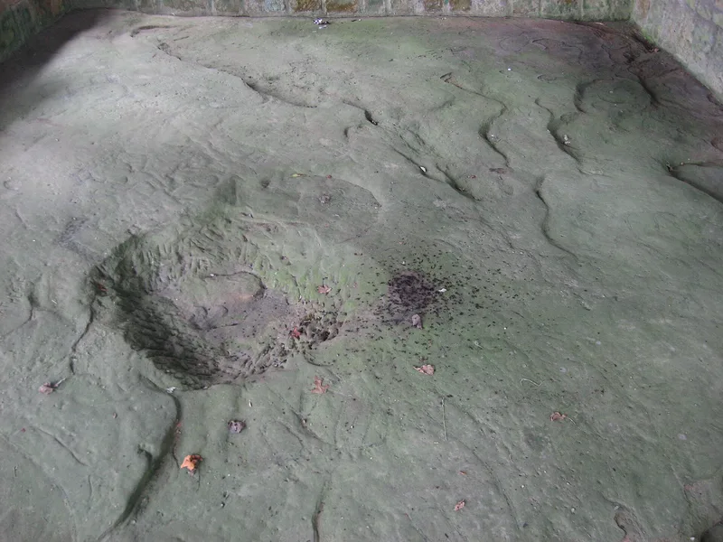
Leo Petroglyph is a prehistoric rock-art site in a hilly part of Jackson County, Ohio, near Coalton. At the head of a ravine, a Black Hand sandstone ledge bears 37 incised drawings, including an owl, hawk, bear, snake and human and animal tracks, along with a chipped basin in the center. Earth and organic matter long covered the ledge and protected the carvings until the owner uncovered them early in the 20th century. The carvings and the nearby rock shelter are attributed to the Fort Ancient Culture, whose farming communities used trails linking salt springs and hunting grounds; this site lay on one such trail. The Ohio Historical Society studied the site in 1905, published findings in 1912, and acquired the 12.332 acres in 1932. A shelter house built in the 1930s with Civilian Conservation Corps help protects the rock, and the site now operates as a state memorial. The carvings' meaning remains unknown.
Significance in brief: The petroglyph and rock shelter are described as one of the most unusual assemblages of prehistoric petroglyphic writings and presumed Indian shelters in Ohio. The 37 incised figures are attributed to the Fort Ancient Culture, and the site lay along a trail linking salt springs and hunting grounds. The meaning and purpose of the carvings remain unknown.
Machine-generated summary. This summary was generated by a language model from the official nomination document and has not been reviewed line by line by an editor. It may contain errors. Check the source document before relying on any detail. Source: nomination document (PDF) · National Archives catalog entry. NRHP reference 70000501, listed November 10, 1970. Summary generated October 2026 (model claude-sonnet-5-5, prompt v1.0-2026-10-29, confidence high).
Key facts
| Address | W of Leo, Coalton |
|---|---|
| County | Jackson County |
| Listed | November 10, 1970 |
| Reference number | 70000501 |
| Resource type | Site |
| Period of significance | Pre-Columbian; ca. 1300 A.D. |
| Areas of significance | Prehistoric, Art |
| Level of significance | State |
| Status (as stated in the nomination) | Open all year as a state memorial in excellent, unaltered condition, with a 1930s shelter house, viewing platform, parking, rest rooms and nature trails; about 35,000 visitors annually. |
| Acreage | 12.3 |
| Coordinates | 39.14974, -82.67567 (NPS GIS) |
What listing means for this property
Sites (archaeological sites, battlefields, landscapes) are often listed with a restricted address to protect them from looting or disturbance. Listing is honorary for private owners; federal undertakings on or near the site go through Section 106 review, and state laws may protect burials and artefacts regardless of listing.
General information, not legal or tax advice. Rules change; confirm with your State Historic Preservation Office or a qualified adviser.
Sources and further reading
- National Park Service, National Register of Historic Places database (snapshot May 2026), reference 70000501.
- Nomination form (PDF, National Archives) — catalog entry
- Wikipedia article (used for cross-checking only; text not reproduced here)
- Wikidata Q6524135
- This listing as JSON
Last updated October 2026. Found an error? See the editorial policy for how to report it.