Hunts Corners

Why it's listed
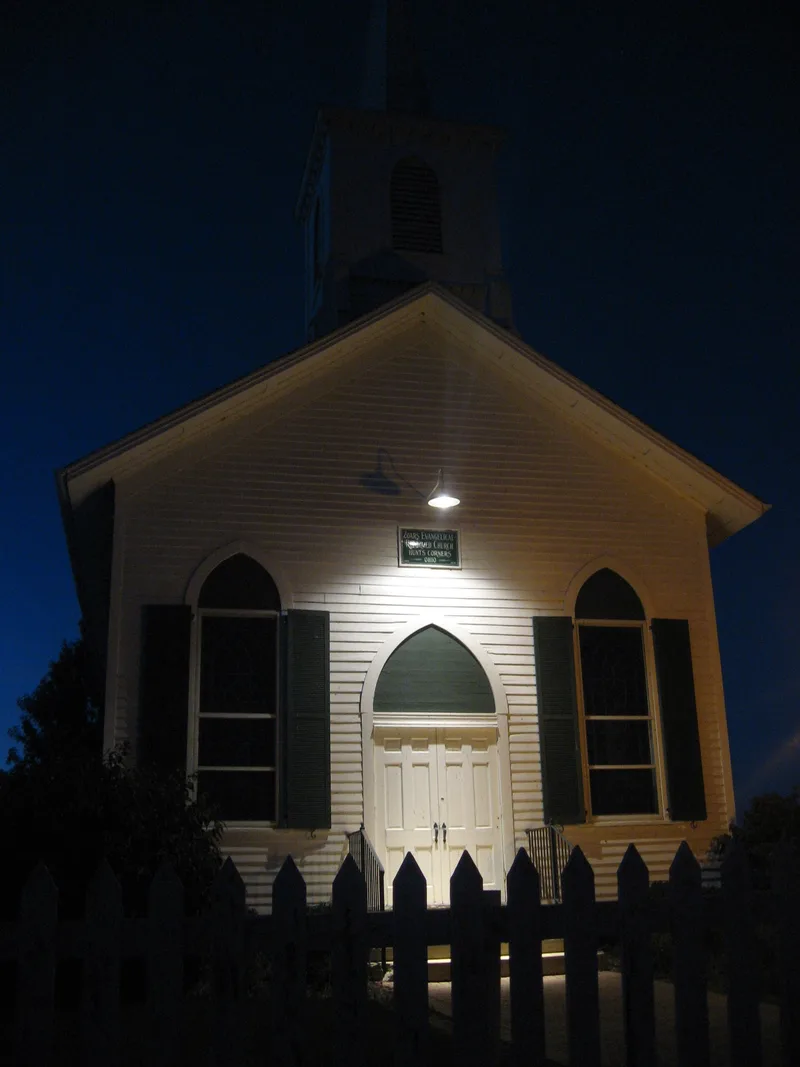
Hunts Corners is a small farming crossroads in Lyme Township, west of Monroeville in Huron County, Ohio, where Sandhill Road meets State Route 547. The 35-acre district contains 14 contributing resources, including a wood-frame church built in 1866, a brick Gothic Revival house from about 1870, a vernacular house from 1857, several barns, outbuildings and the Herner-Martin drainage ditch. Surrounding fields are still farmed. The settlement was named for Heil Hunt and grew after German families arrived in the late 1840s, among them Philip William Heymann and his relatives. The community organized a Reformed congregation and built its church in 1866 on donated land and timber. The crossroads also had a blacksmith shop, a store and a school, and a local newspaper carried a column of Hunts Corners news. The district was listed for its role in illustrating rural settlement and development in north-central Ohio, with a period of significance from 1850 to 1943.
Significance in brief: The district is significant under Criterion A in the area of Exploration/Settlement as a good example of a rural crossroads community in north-central Ohio. It was built largely by German-American settlers, especially the Heymann family, beginning in the mid-19th century. It shows typical settlement patterns of Yankee origins followed by German immigration and American vernacular building.
Machine-generated summary. This summary was generated by a language model from the official nomination document and has not been reviewed line by line by an editor. It may contain errors. Check the source document before relying on any detail. Source: nomination document (PDF) · National Archives catalog entry. NRHP reference 93000896, listed September 2, 1993. Summary generated October 2026 (model claude-sonnet-5-5, prompt v1.0-2026-10-29, confidence high).
Key facts
| Address | Jct. of Sandhill Rd. and OH 547, Monroeville |
|---|---|
| County | Huron County |
| Listed | September 2, 1993 |
| Reference number | 93000896 |
| Resource type | District |
| Period of significance | 1850-1943 |
| Architect / builder | Unknown |
| Architectural style | Gothic Revival; late nineteenth-century vernacular |
| Criteria |
|
| Areas of significance | Exploration/Settlement |
| Level of significance | Local |
| Status (as stated in the nomination) | The area is still farmed and still functions as a crossroads settlement. One house is used as a bed-and-breakfast, and a former blacksmith shop site is an empty lot. |
| Acreage | 17 |
| Coordinates | 41.22576, -82.75621 (NPS GIS) |
What listing means for this property
This is a historic district. Buildings within its boundary are either contributing (they add to the district's significance) or non-contributing. Owners of contributing income-producing buildings can claim the 20% federal rehabilitation tax credit; homeowners should look at state credits. National Register districts impose no design review by themselves; a local historic district ordinance, if one exists, does (the difference explained).
General information, not legal or tax advice. Rules change; confirm with your State Historic Preservation Office or a qualified adviser.
Sources and further reading
- National Park Service, National Register of Historic Places database (snapshot May 2026), reference 93000896.
- Nomination form (PDF, National Archives) — catalog entry
- Wikipedia article (used for cross-checking only; text not reproduced here)
- Wikidata Q5945743
- This listing as JSON
Last updated October 2026. Found an error? See the editorial policy for how to report it.